MyTopo
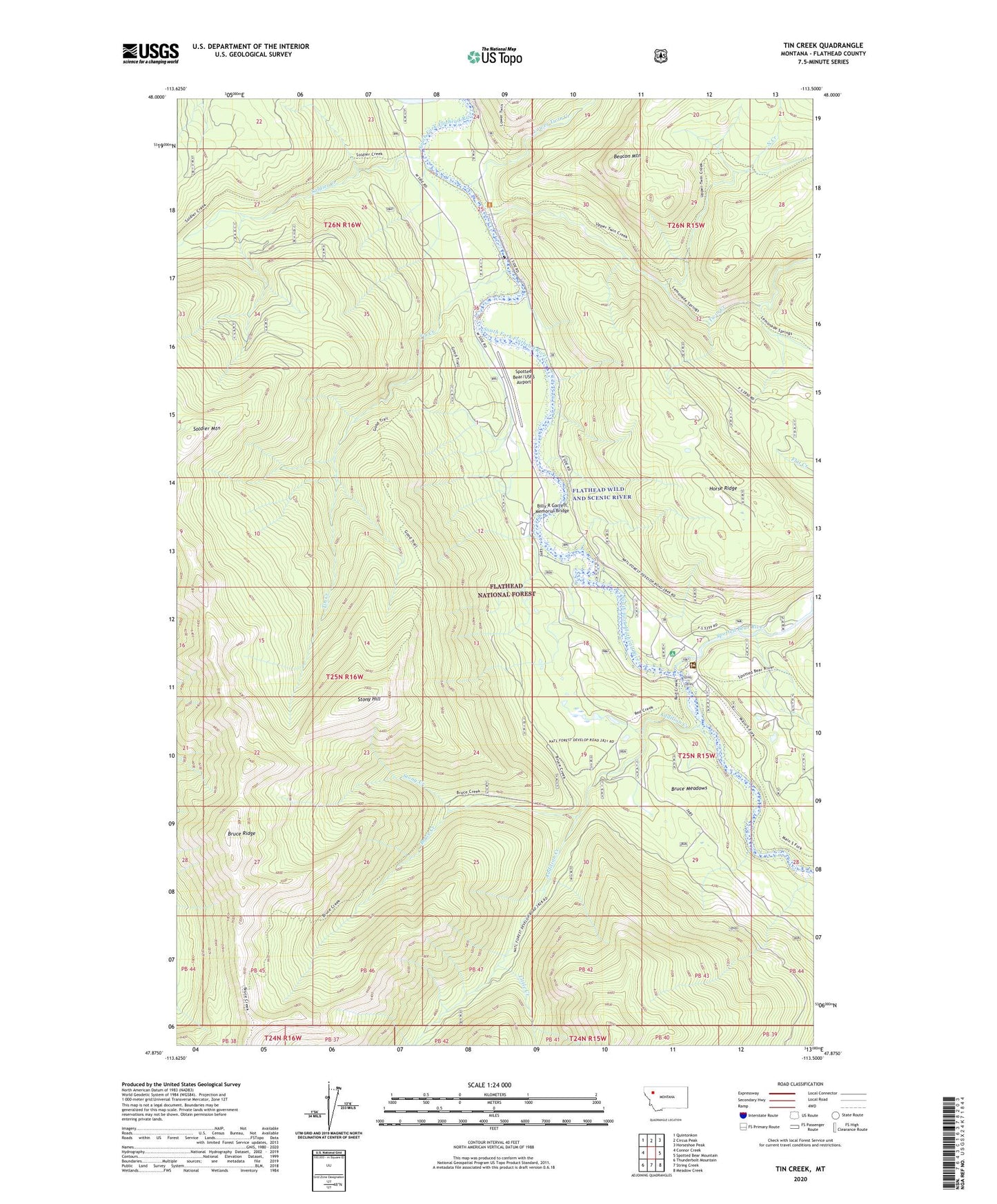
Tin Creek Montana US Topo Map
Couldn't load pickup availability
Also explore the Tin Creek Forest Service Topo of this same quad for updated USFS data
2024 topographic map quadrangle Tin Creek in the state of Montana. Scale: 1:24000. Based on the newly updated USGS 7.5' US Topo map series, this map is in the following counties: Flathead. The map contains contour data, water features, and other items you are used to seeing on USGS maps, but also has updated roads and other features. This is the next generation of topographic maps. Printed on high-quality waterproof paper with UV fade-resistant inks.
Quads adjacent to this one:
West: Connor Creek
Northwest: Quintonkon
North: Circus Peak
Northeast: Horseshoe Peak
East: Spotted Bear Mountain
Southeast: Meadow Creek
South: String Creek
Southwest: Thunderbolt Mountain
This map covers the same area as the classic USGS quad with code o47113h5.
Contains the following named places: Addition Creek, Beacon Mountain, Billy R Garrett Memorial Bridge, Bruce Creek, Bruce Meadows, Bruce Ridge, Horse Ridge, Little Creek, Lower Twin Creek, North Creek, Red Creek, Soldier Creek, Soldier Mountain, South Fork River Access, Spotted Bear Campground, Spotted Bear Ranger Station, Spotted Bear River, Spotted Bear/USFS Airport, Stony Creek, Stony Hill, Tin Creek, Twin Creek