MyTopo
Corley Gulch Montana US Topo Map
Couldn't load pickup availability
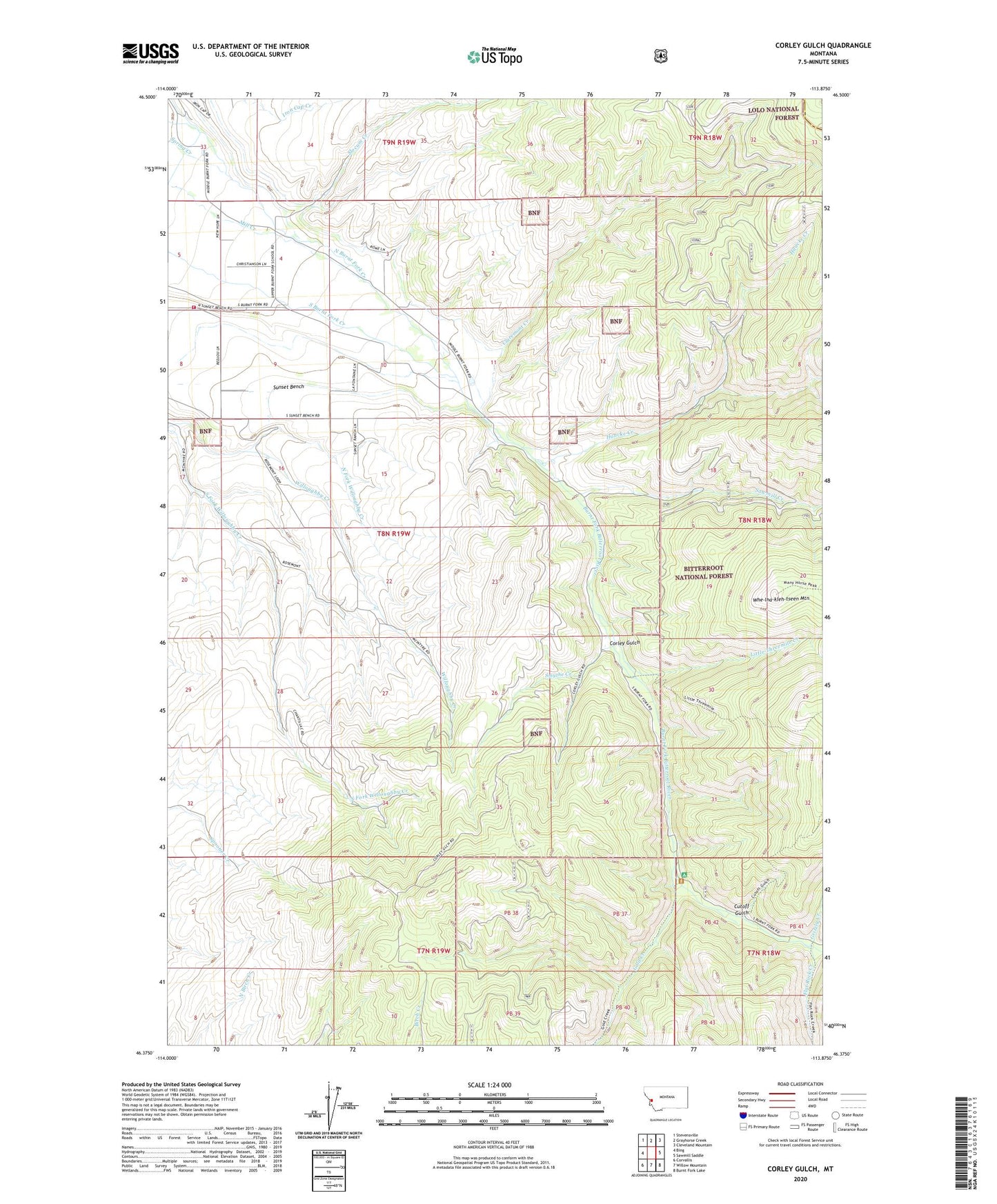
2020 topographic map quadrangle Corley Gulch in the state of Montana. Scale: 1:24000. Based on the newly updated USGS 7.5' US Topo map series, this map is in the following counties: Ravalli, Granite. The map contains contour data, water features, and other items you are used to seeing on USGS maps, but also has updated roads and other features. This is the next generation of topographic maps. Printed on high-quality waterproof paper with UV fade-resistant inks.
Quads adjacent to this one:
West: Bing
Northwest: Stevensville
North: Grayhorse Creek
Northeast: Cleveland Mountain
East: Sawmill Saddle
Southeast: Burnt Fork Lake
South: Willow Mountain
Southwest: Corvallis
Contains the following named places: 08N19W11CDBB01 Well, Burnt Fork, Burnt Fork Bitterroot River, Burnt Fork School, Claremont Creek, Corley Gulch, Cutoff Gulch, Cutoff Gulch Campground, Flat Rock Creek, Gold Creek, Gold Creek Campground, Gold Creek Trailhead, Grizzly Creek, Haacke Creek, Little Threemile Creek, North Fork Willoughby Creek, NW SW Section 9 Mine, Rosemont Post Office, Rosemont School, Sawmill Creek, SE NW Section 7 Mine, Slocum Creek, Smythe Creek, Stevensville Rural Fire Station, Whe-lha-kleh-tseen Mountain