MyTopo
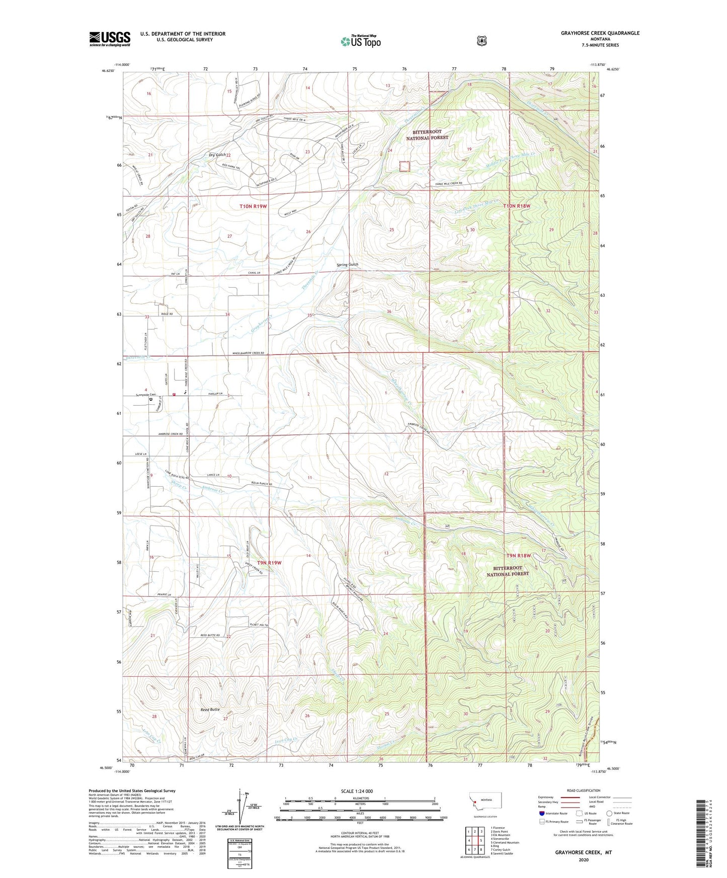
Grayhorse Creek Montana US Topo Map
Couldn't load pickup availability
Also explore the Grayhorse Creek Forest Service Topo of this same quad for updated USFS data
2024 topographic map quadrangle Grayhorse Creek in the state of Montana. Scale: 1:24000. Based on the newly updated USGS 7.5' US Topo map series, this map is in the following counties: Ravalli, Granite. The map contains contour data, water features, and other items you are used to seeing on USGS maps, but also has updated roads and other features. This is the next generation of topographic maps. Printed on high-quality waterproof paper with UV fade-resistant inks.
Quads adjacent to this one:
West: Stevensville
Northwest: Florence
North: Davis Point
Northeast: Elk Mountain
East: Cleveland Mountain
Southeast: Sawmill Saddle
South: Corley Gulch
Southwest: Bing
This map covers the same area as the classic USGS quad with code o46113e8.
Contains the following named places: 09N19W10BB__01 Well, 09N19W14CBCC01 Well, 09N19W14CBCD01 Well, Grayhorse Creek, Iron Cap Mine, Left Fork Three Mile Creek, Lone Rock School, Middle Fork Three Mile Creek, Reed Butte, Sheep Creek, Spring Gulch, Sunnyside Cemetery, Three Mile Creek Mine, Three Mile Fire Department Station 1, Threemile State Wildlife Management Area, Wheelbarrow Creek