MyTopo
Cleveland Mountain Montana US Topo Map
Couldn't load pickup availability
Also explore the Cleveland Mountain Forest Service Topo of this same quad for updated USFS data
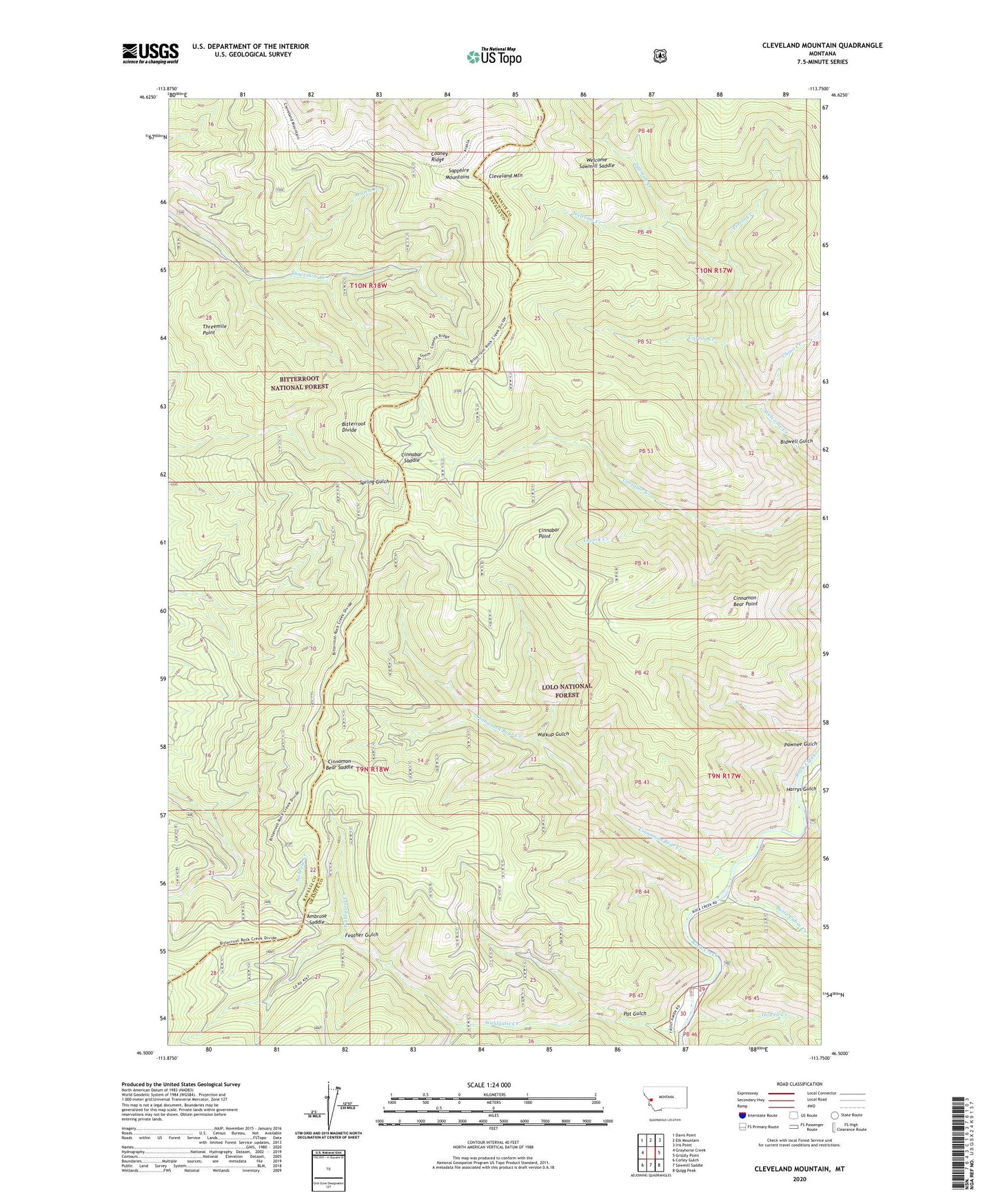
2024 topographic map quadrangle Cleveland Mountain in the state of Montana. Scale: 1:24000. Based on the newly updated USGS 7.5' US Topo map series, this map is in the following counties: Granite, Ravalli. The map contains contour data, water features, and other items you are used to seeing on USGS maps, but also has updated roads and other features. This is the next generation of topographic maps. Printed on high-quality waterproof paper with UV fade-resistant inks.
Quads adjacent to this one:
West: Grayhorse Creek
Northwest: Davis Point
North: Elk Mountain
Northeast: Iris Point
East: Grizzly Point
Southeast: Quigg Peak
South: Sawmill Saddle
Southwest: Corley Gulch
This map covers the same area as the classic USGS quad with code o46113e7.
Contains the following named places: Ambrose Saddle, Arasta Creek, Bidwell Gulch, Bitterroot Divide, Butte Cabin Creek, Carron Creek, Chino Creek, Cinnabar Point, Cinnabar Saddle, Cinnamon Bear Creek, Cinnamon Bear Point, Cinnamon Bear Saddle, Cleveland Mine, Cleveland Mountain, Cooney Ridge, Feather Gulch, Ferret Creek, Harrys Flat Campground, Harrys Gulch, Howell Creek, Laveck Creek, Pat Gulch, Pawnee Gulch, Spartan Creek, Threemile Point, Wahlquist Creek, Walkup Gulch, Welcome Sawmill Saddle