MyTopo
Cornish Gulch Montana US Topo Map
Couldn't load pickup availability
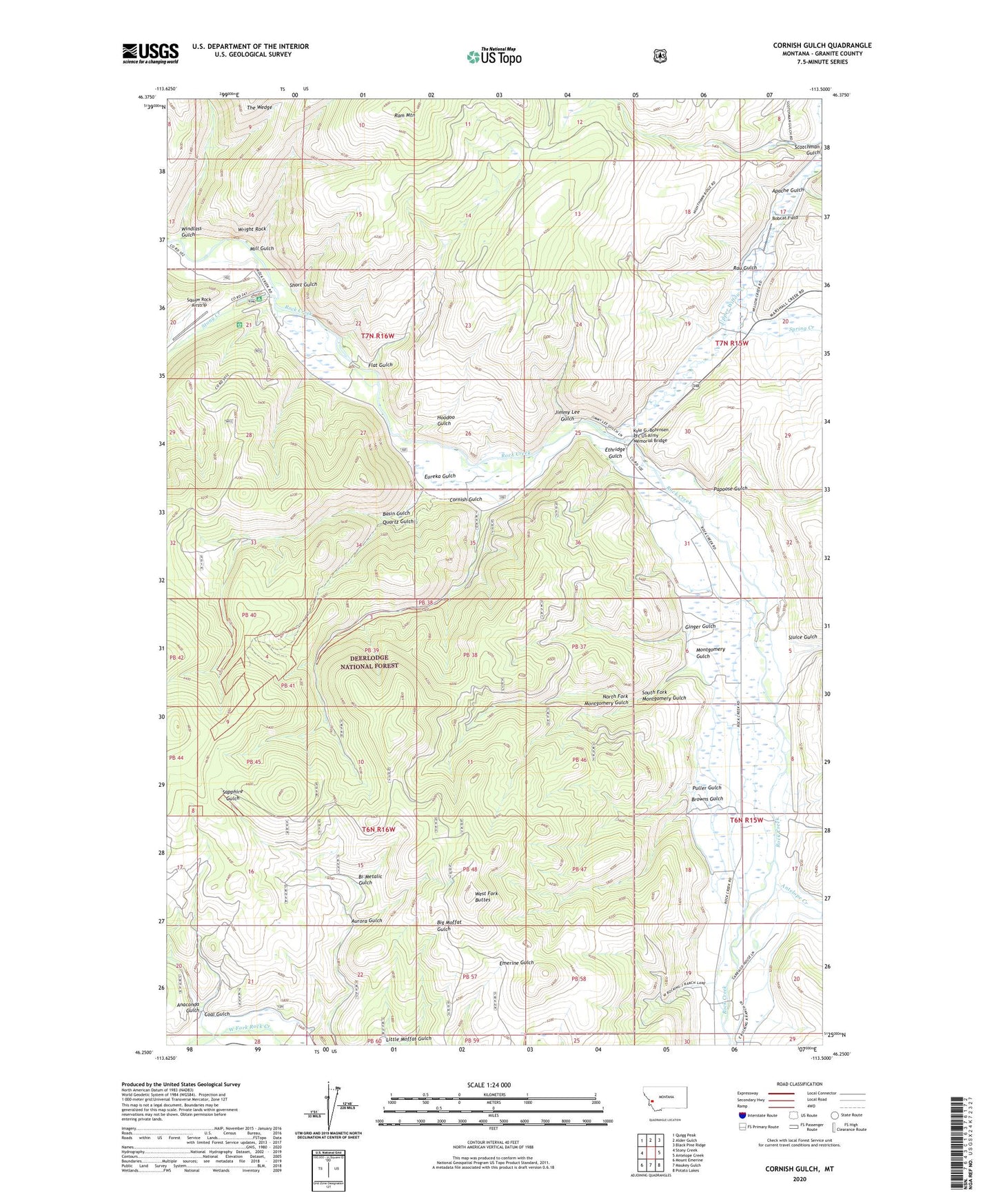
2020 topographic map quadrangle Cornish Gulch in the state of Montana. Scale: 1:24000. Based on the newly updated USGS 7.5' US Topo map series, this map is in the following counties: Granite. The map contains contour data, water features, and other items you are used to seeing on USGS maps, but also has updated roads and other features. This is the next generation of topographic maps. Printed on high-quality waterproof paper with UV fade-resistant inks.
Quads adjacent to this one:
West: Stony Creek
Northwest: Quigg Peak
North: Alder Gulch
Northeast: Black Pine Ridge
East: Antelope Creek
Southeast: Potato Lakes
South: Maukey Gulch
Southwest: Mount Emerine
Contains the following named places: Anaconda Gulch, Antelope Creek, Apache Gulch, Aurora Gulch, Basin Gulch, Basin Gulch Placer Mine, Bi-Metalic Gulch, Blue Bell Mine, Bobcat Field, Browns Gulch, Coal Gulch, Cornish Gulch, Ethridge Gulch, Eureka Gulch, Flat Gulch, Ginger Gulch, Hoodoo Gulch, Jimmy Lee Gulch, Kyle G. Bohrnsen Pfc US Army Memorial Bridge, Little Moffat Gulch, Mill Gulch, Montgomery Gulch, North Fork Montgomery Gulch, NW NE Section 20 Mine, NW SW Section 25 Mine, Papoose Gulch, Placer Post Office, Puller Gulch, Quartz Gulch, Ram Mountain, Rau Gulch, Scotchman Gulch, SE NE Section 26 Mine, Short Gulch, Silver King Mine, Sluice Gulch, South Fork Montgomery Gulch, Spring Creek, Squaw Rock Airstrip, Stony Creek, Stony Creek Campground, SW NE Section 5 Mine, The Wedge, Upper Willow Creek, WB Development Placer Mine, West Fork Buttes, Windlass Gulch, Wright Rock