MyTopo
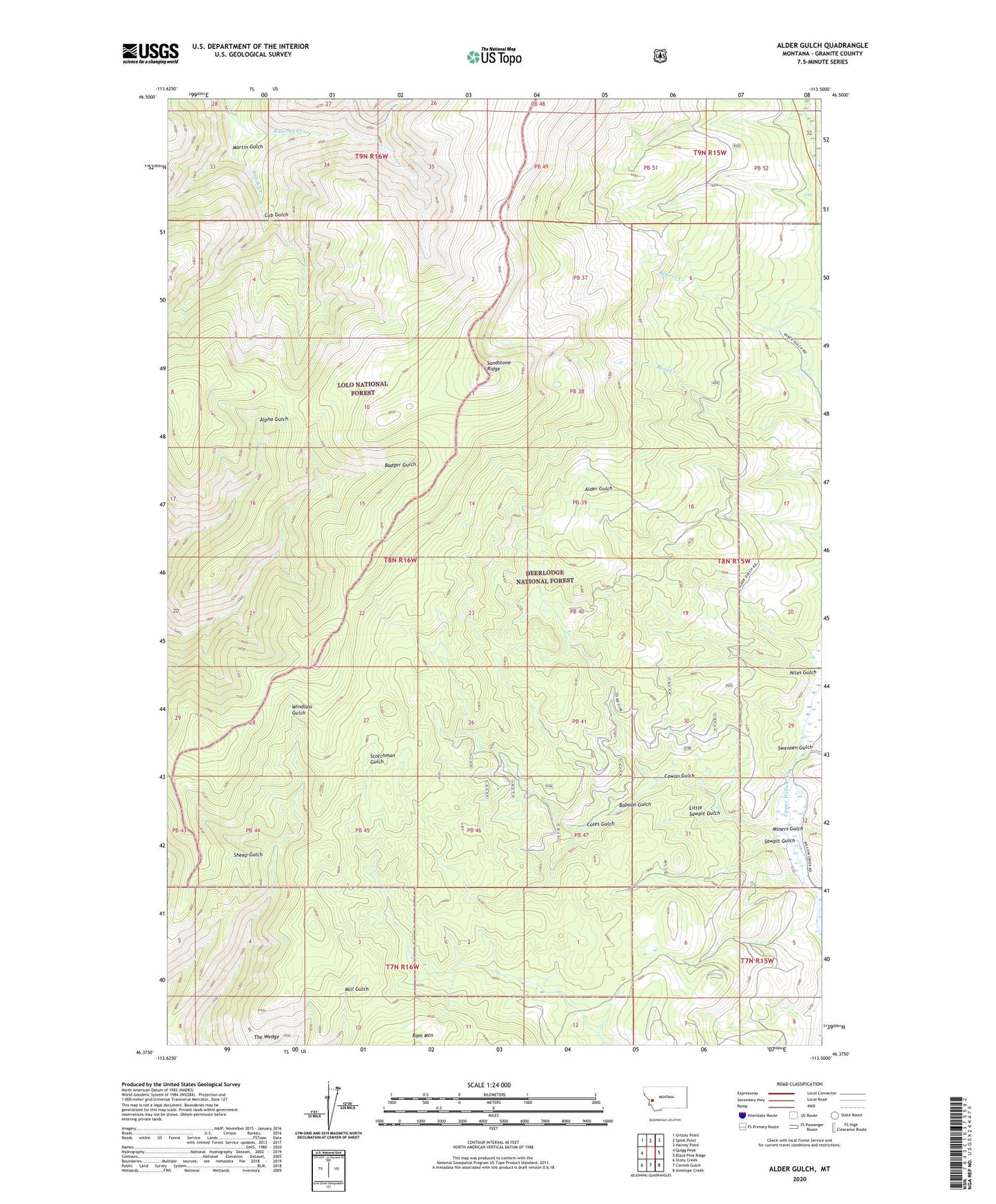
Alder Gulch Montana US Topo Map
Couldn't load pickup availability
Also explore the Alder Gulch Forest Service Topo of this same quad for updated USFS data
2024 topographic map quadrangle Alder Gulch in the state of Montana. Scale: 1:24000. Based on the newly updated USGS 7.5' US Topo map series, this map is in the following counties: Granite. The map contains contour data, water features, and other items you are used to seeing on USGS maps, but also has updated roads and other features. This is the next generation of topographic maps. Printed on high-quality waterproof paper with UV fade-resistant inks.
Quads adjacent to this one:
West: Quigg Peak
Northwest: Grizzly Point
North: Spink Point
Northeast: Harvey Point
East: Black Pine Ridge
Southeast: Antelope Creek
South: Cornish Gulch
Southwest: Stony Creek
This map covers the same area as the classic USGS quad with code o46113d5.
Contains the following named places: Baboon Gulch, Coles Gulch, Cowan Gulch, Cub Gulch, Deadwood Gulch, Horse Canyon Creek, Little Sawpit Gulch, Martin Gulch, Miners Gulch, Niles Gulch, Ramona Creek, Ranch Creek Trail, Sandstone Ridge, Sandstone Ridge Trail, Sawpit Gulch, Swensen Gulch