MyTopo
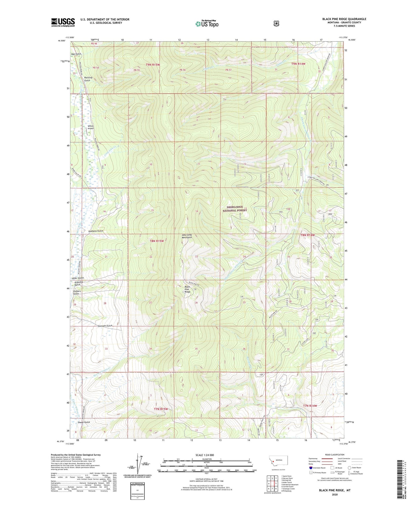
Black Pine Ridge Montana US Topo Map
Couldn't load pickup availability
Also explore the Black Pine Ridge Forest Service Topo of this same quad for updated USFS data
2024 topographic map quadrangle Black Pine Ridge in the state of Montana. Scale: 1:24000. Based on the newly updated USGS 7.5' US Topo map series, this map is in the following counties: Granite. The map contains contour data, water features, and other items you are used to seeing on USGS maps, but also has updated roads and other features. This is the next generation of topographic maps. Printed on high-quality waterproof paper with UV fade-resistant inks.
Quads adjacent to this one:
West: Alder Gulch
Northwest: Spink Point
North: Harvey Point
Northeast: Nirling Hill
East: Henderson Mountain
Southeast: Philipsburg
South: Antelope Creek
Southwest: Cornish Gulch
This map covers the same area as the classic USGS quad with code o46113d4.
Contains the following named places: Alder Gulch, Arbuckle Gulch, Bear Creek, Beaver Creek, Black Pine Lookout Tower, Black Pine Ridge, Black Pine Ridge Trail Number 6, Combination Trail Number 3, Copper Creek, Day Gulch, Granite County, Huebeck Gulch, John Long Mountains, Long John Creek, Maloney Trail Number 5, Rattling Gulch, Sheep Gulch, Slussers Gulch, Willow Airport