MyTopo
Cow Creek Montana US Topo Map
Couldn't load pickup availability
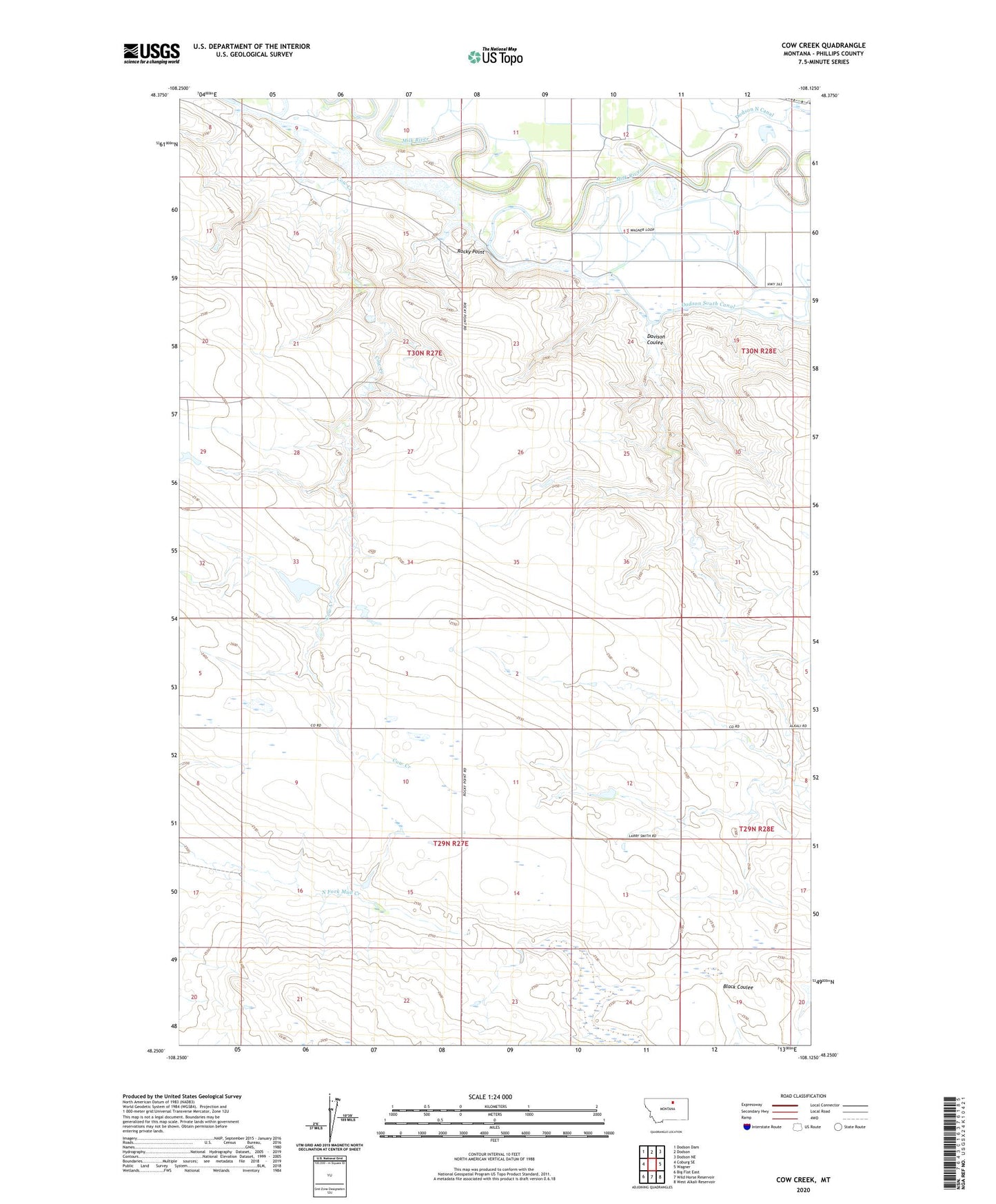
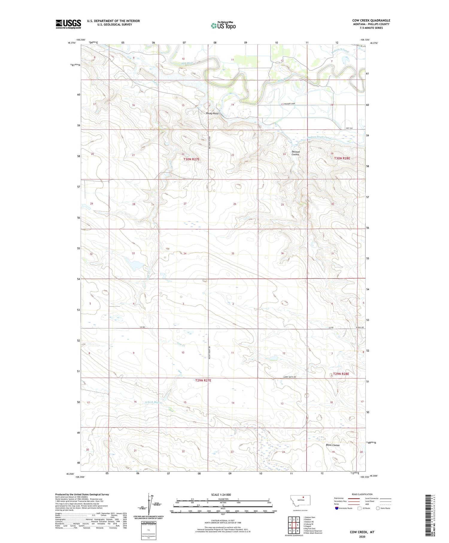
2020 topographic map quadrangle Cow Creek in the state of Montana. Scale: 1:24000. Based on the newly updated USGS 7.5' US Topo map series, this map is in the following counties: Phillips. The map contains contour data, water features, and other items you are used to seeing on USGS maps, but also has updated roads and other features. This is the next generation of topographic maps. Printed on high-quality waterproof paper with UV fade-resistant inks.
Quads adjacent to this one:
West: Coburg SE
Northwest: Dodson Dam
North: Dodson
Northeast: Dodson NE
East: Wagner
Southeast: West Alkali Reservoir
South: Wild Horse Reservoir
Southwest: Big Flat East
Contains the following named places: Colmen School, Cow Creek, Davison Coulee, Dodson South Canal, O K School, Pet Rock Dam, Point of Rocks Reservoir, Rocky Point