MyTopo
Dodson Dam Montana US Topo Map
Couldn't load pickup availability
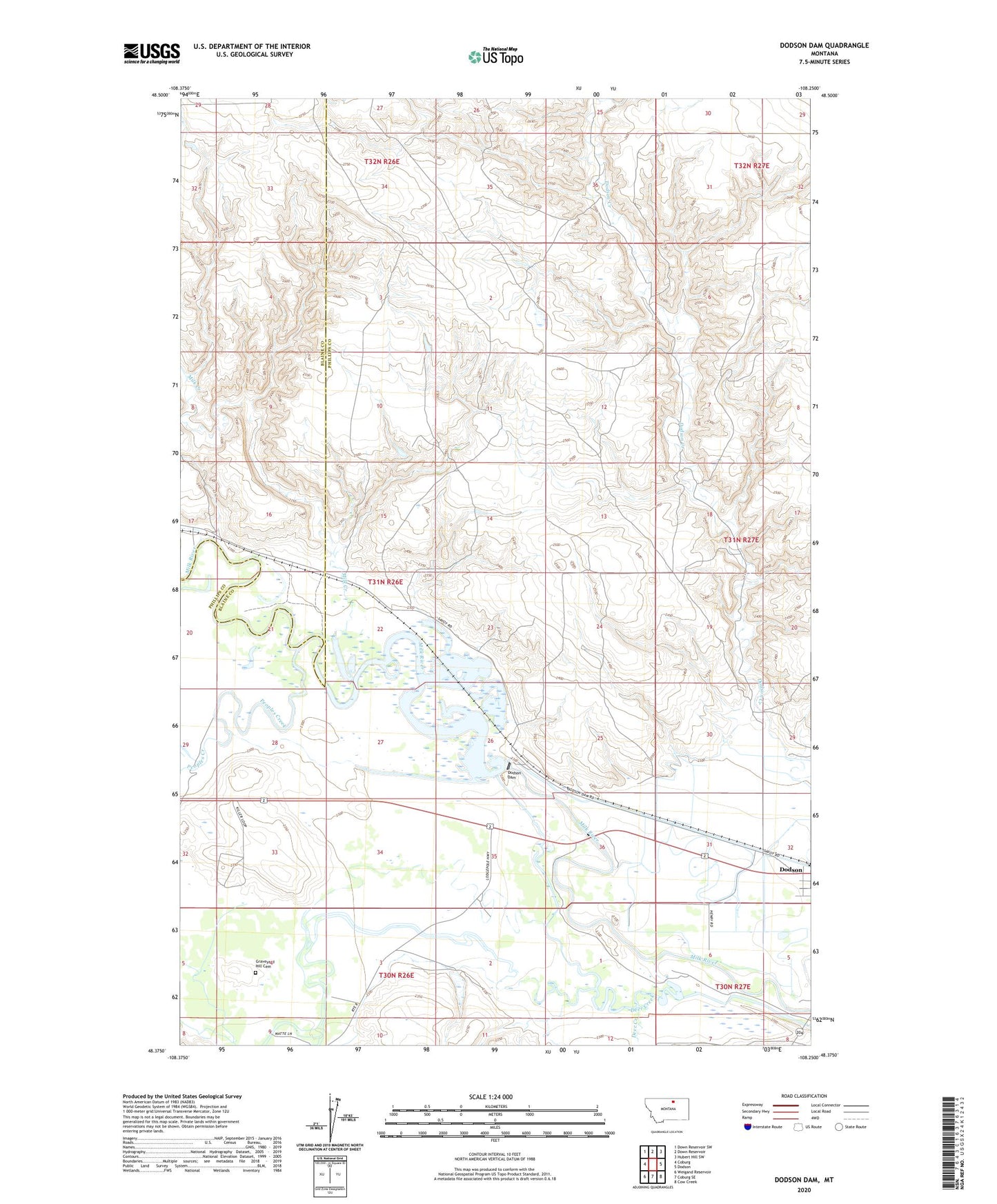
2024 topographic map quadrangle Dodson Dam in the state of Montana. Scale: 1:24000. Based on the newly updated USGS 7.5' US Topo map series, this map is in the following counties: Phillips, Blaine. The map contains contour data, water features, and other items you are used to seeing on USGS maps, but also has updated roads and other features. This is the next generation of topographic maps. Printed on high-quality waterproof paper with UV fade-resistant inks.
Quads adjacent to this one:
West: Coburg
Northwest: Down Reservoir SW
North: Down Reservoir
Northeast: Hubert Hill SW
East: Dodson
Southeast: Cow Creek
South: Coburg SE
Southwest: Weigand Reservoir
This map covers the same area as the classic USGS quad with code o48108d3.
Contains the following named places: 30N26E03CCBC01 Well, 30N26E03DBA_01 Well, 31N26E32ADD_01 Well, 31N26E33CCB_01 Well, 31N26E33DBCA01 Well, Bakers Post, Deer Creek, Dodson Diversion Dam, Fort Browning, Graveyard Hill Cemetery, Haro, M Newby Dam, Milk Creek, Milk River - Dodson Dam Unit Wildlife Management Area, Peoples Creek, Rock Spring School, Strike Reservoir Dam, Survant