MyTopo
Cow Island Montana US Topo Map
Couldn't load pickup availability
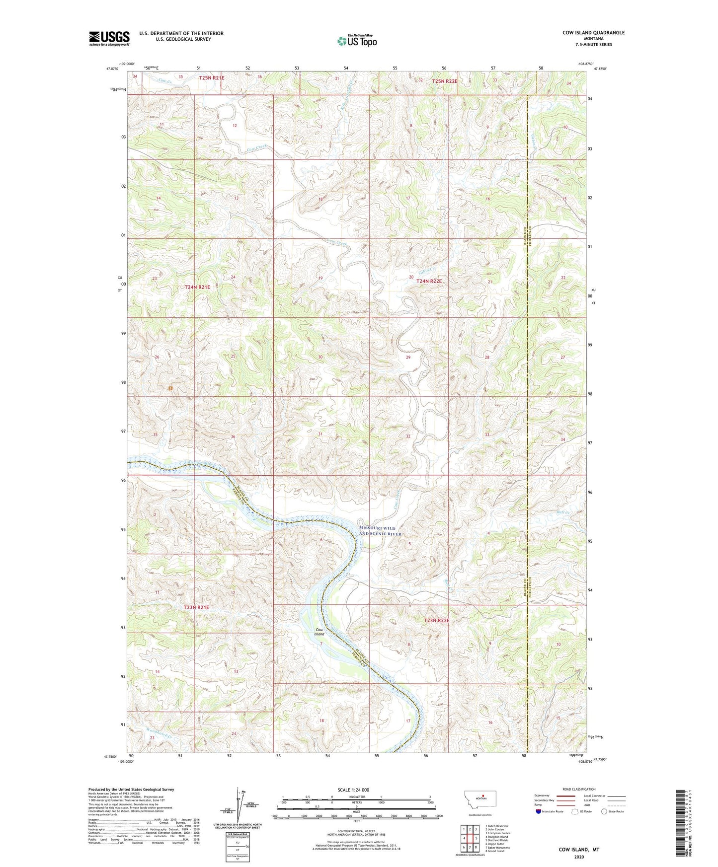
2024 topographic map quadrangle Cow Island in the state of Montana. Scale: 1:24000. Based on the newly updated USGS 7.5' US Topo map series, this map is in the following counties: Blaine, Fergus, Phillips. The map contains contour data, water features, and other items you are used to seeing on USGS maps, but also has updated roads and other features. This is the next generation of topographic maps. Printed on high-quality waterproof paper with UV fade-resistant inks.
Quads adjacent to this one:
West: Sturgeon Island
Northwest: Butch Reservoir
North: John Coulee
Northeast: Crazyman Coulee
East: Shetland Divide
Southeast: Grand Island
South: Baker Monument
Southwest: Reppe Butte
This map covers the same area as the classic USGS quad with code o47108g8.
Contains the following named places: Bull Creek, Cabin Creek, Cow Creek, Cow Island, Kills At Night Creek, Kip Homestead, Sixty Dam