MyTopo
Reppe Butte Montana US Topo Map
Couldn't load pickup availability
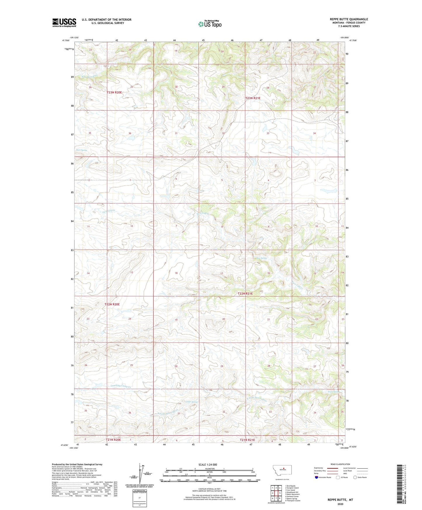
2024 topographic map quadrangle Reppe Butte in the state of Montana. Scale: 1:24000. Based on the newly updated USGS 7.5' US Topo map series, this map is in the following counties: Fergus. The map contains contour data, water features, and other items you are used to seeing on USGS maps, but also has updated roads and other features. This is the next generation of topographic maps. Printed on high-quality waterproof paper with UV fade-resistant inks.
Quads adjacent to this one:
West: Woodhawk Hill
Northwest: Bird Rapids
North: Sturgeon Island
Northeast: Cow Island
East: Baker Monument
Southeast: Thompson Coulee
South: Bakers Spring
Southwest: Gerhard Corner
This map covers the same area as the classic USGS quad with code o47109f1.
Contains the following named places: 22N20E02CBB_01 Well, Andeville Post Office, Bow Spring, Hess Dam, Lambing Camp Creek, Lewis Spring, Linder Spring, Reppe Butte, Sullivan Ridge, Two Calf School