MyTopo
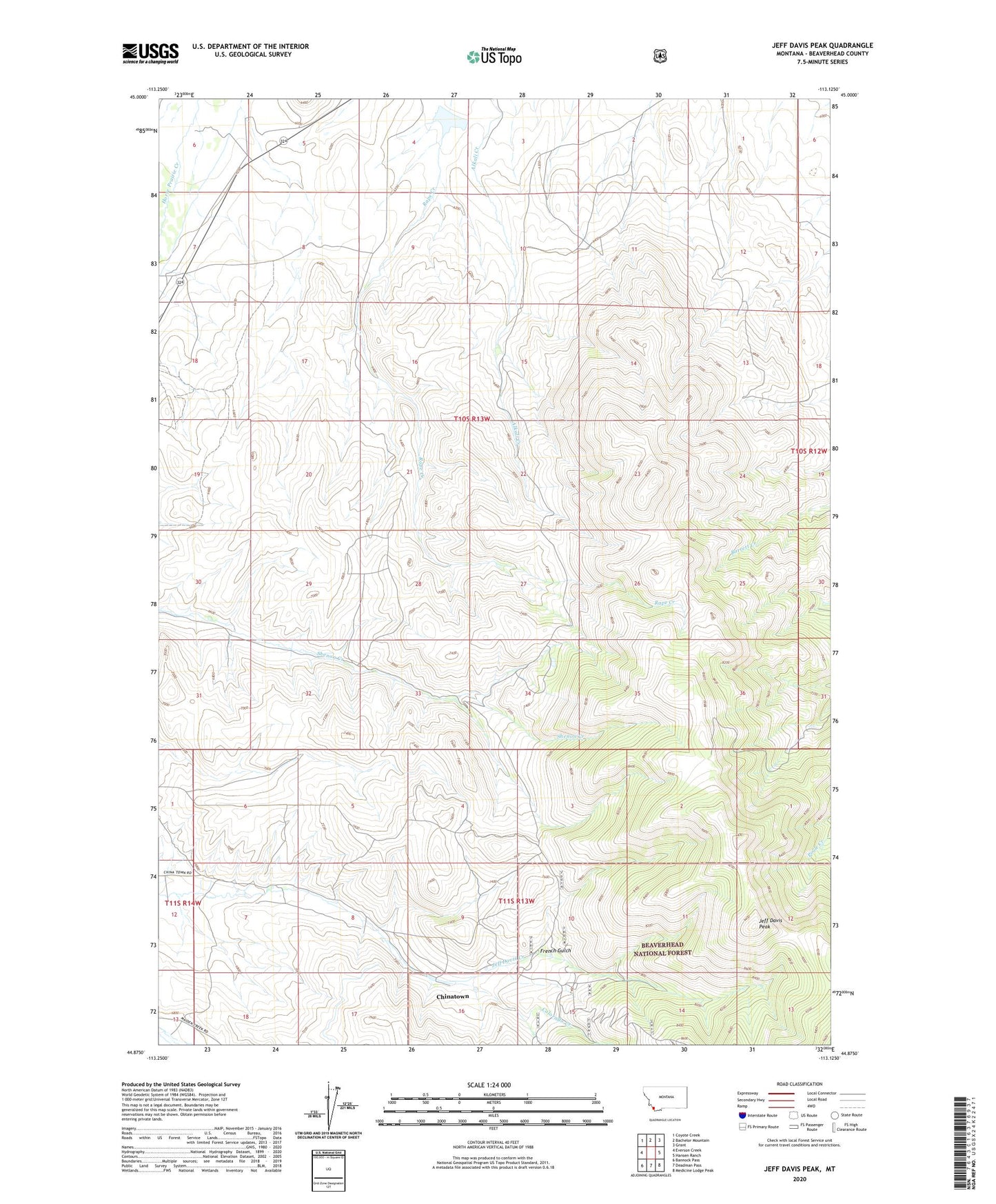
Jeff Davis Peak Montana US Topo Map
Couldn't load pickup availability
Also explore the Jeff Davis Peak Forest Service Topo of this same quad for updated USFS data
2024 topographic map quadrangle Jeff Davis Peak in the state of Montana. Scale: 1:24000. Based on the newly updated USGS 7.5' US Topo map series, this map is in the following counties: Beaverhead. The map contains contour data, water features, and other items you are used to seeing on USGS maps, but also has updated roads and other features. This is the next generation of topographic maps. Printed on high-quality waterproof paper with UV fade-resistant inks.
Quads adjacent to this one:
West: Everson Creek
Northwest: Coyote Creek
North: Bachelor Mountain
Northeast: Grant
East: Hansen Ranch
Southeast: Medicine Lodge Peak
South: Deadman Pass
Southwest: Bannock Pass
This map covers the same area as the classic USGS quad with code o44113h2.
Contains the following named places: Brenner, Brenner Post Office, Brenner School, Chinatown, Colorado Creek, French Gulch, J Barrett Dam, Jeff Davis Peak, Lucky Strike Mine, Mansfield Cow Camp