MyTopo
Deep Creek Park Montana US Topo Map
Couldn't load pickup availability
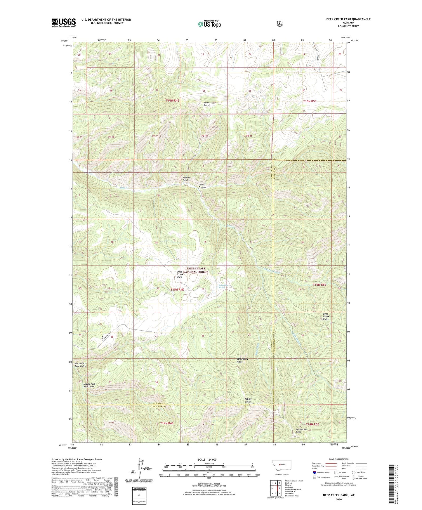
2020 topographic map quadrangle Deep Creek Park in the state of Montana. Scale: 1:24000. Based on the newly updated USGS 7.5' US Topo map series, this map is in the following counties: Cascade, Meagher. The map contains contour data, water features, and other items you are used to seeing on USGS maps, but also has updated roads and other features. This is the next generation of topographic maps. Printed on high-quality waterproof paper with UV fade-resistant inks.
Quads adjacent to this one:
West: Millegan
Northwest: Boston Coulee School
North: Calvert
Northeast: Evans
East: Blankenbaker Flats
Southeast: Monument Peak
South: Bald Hills
Southwest: Lingshire NE
Contains the following named places: Deep Creek Park, Deer Butte, Desolation Peak, Devil Canyon, Middle Fork Bear Gulch, North Fork Bear Gulch, North Fork Deep Creek, Robertson Spring, Smart Fork, South Fork Deep Creek, Strawberry Ridge, Temple Gulch