MyTopo
Diamond City Montana US Topo Map
Couldn't load pickup availability
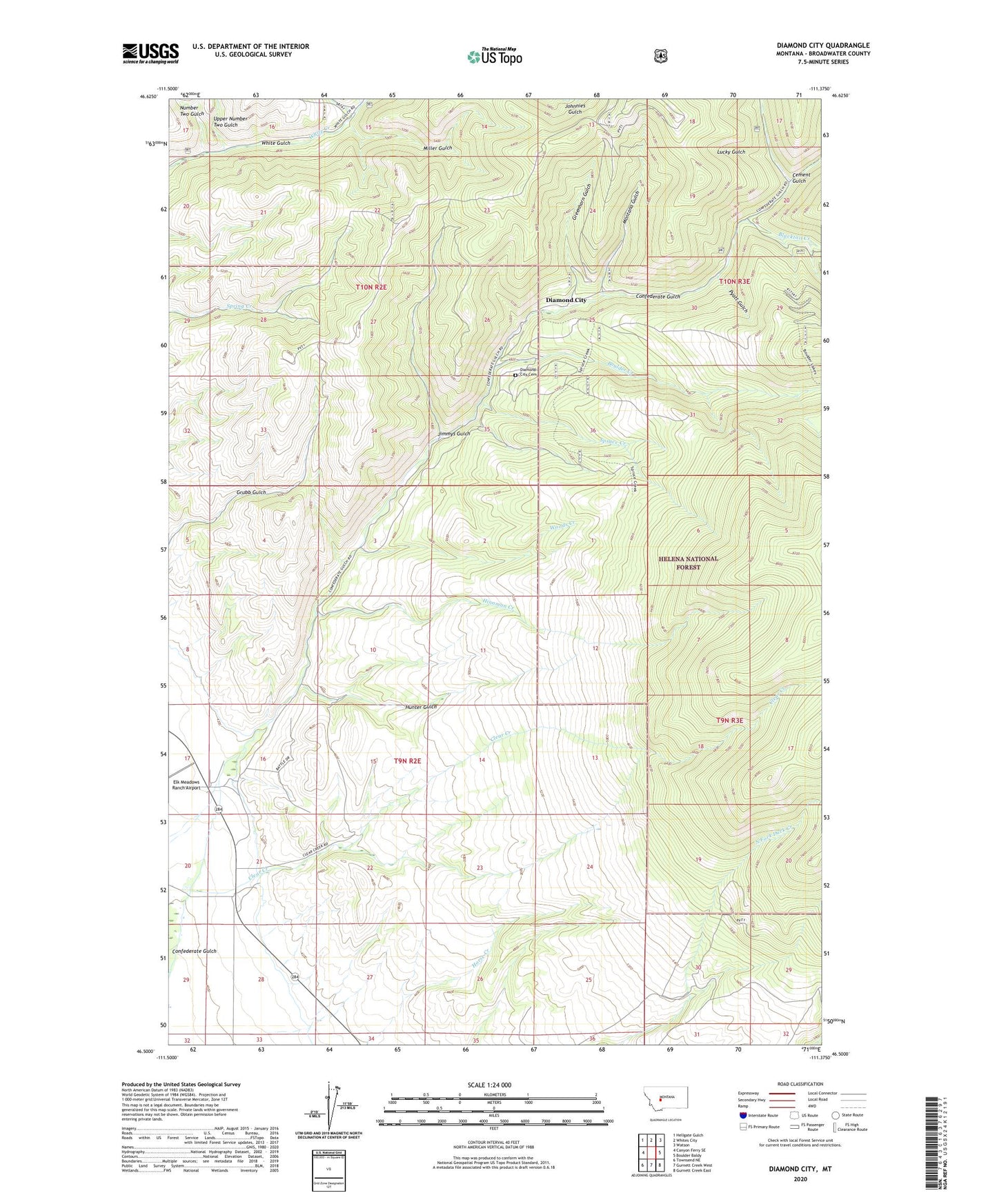
2020 topographic map quadrangle Diamond City in the state of Montana. Scale: 1:24000. Based on the newly updated USGS 7.5' US Topo map series, this map is in the following counties: Broadwater. The map contains contour data, water features, and other items you are used to seeing on USGS maps, but also has updated roads and other features. This is the next generation of topographic maps. Printed on high-quality waterproof paper with UV fade-resistant inks.
Quads adjacent to this one:
West: Canyon Ferry SE
Northwest: Hellgate Gulch
North: Whites City
Northeast: Watson
East: Boulder Baldy
Southeast: Gurnett Creek East
South: Gurnett Creek West
Southwest: Townsend NE
Contains the following named places: 09N02E16CCCD01 Well, 09N02E16CDAD01 Well, Baker Mine, Barker, Blacktail Creek, Boom Mine, Boulder, Boulder Creek, Cement Gulch, Cement Gulch City, Clear Creek, Diamond City, Diamond City Cemetery, Diamond City Post Office, El Dorado, Elk Meadows Ranch Airport, Greenhorn Gulch, Hinaman Creek, Hunter Gulch, Jimmys Gulch, Johnson Post Office, Johnson School, Lucky Gulch, Miller Gulch, Miller Mine, Montana Gulch, Montana Regent Mine, NE NW Section 25 Mine, NE SW Section 26 Mine, Noble, Number Two Gulch, Pyatt Gulch, Silver Snowflake Mine, Springs Gulch, Springs Gulch Creek, Spruce Creek, Upper Number 2 Gulch Mine, Upper Number Two Gulch, Woods Creek