MyTopo
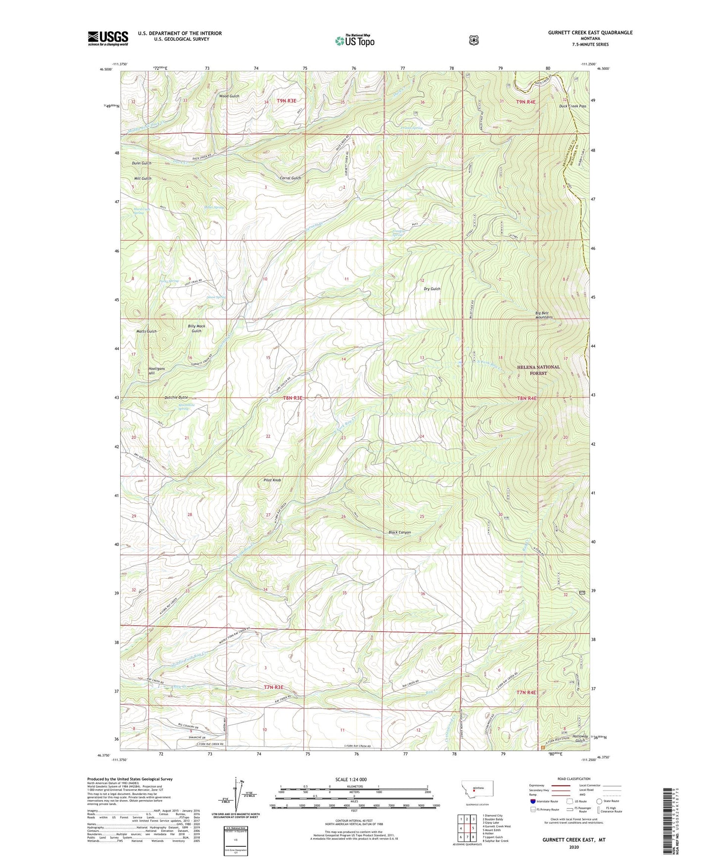
Gurnett Creek East Montana US Topo Map
Couldn't load pickup availability
Also explore the Gurnett Creek East Forest Service Topo of this same quad for updated USFS data
2024 topographic map quadrangle Gurnett Creek East in the state of Montana. Scale: 1:24000. Based on the newly updated USGS 7.5' US Topo map series, this map is in the following counties: Broadwater, Meagher. The map contains contour data, water features, and other items you are used to seeing on USGS maps, but also has updated roads and other features. This is the next generation of topographic maps. Printed on high-quality waterproof paper with UV fade-resistant inks.
Quads adjacent to this one:
West: Gurnett Creek West
Northwest: Diamond City
North: Boulder Baldy
Northeast: Gipsy Lake
East: Mount Edith
Southeast: Sulphur Bar Creek
South: Lippert Gulch
Southwest: Holker
This map covers the same area as the classic USGS quad with code o46111d3.
Contains the following named places: Big Belt Mountains, Biggs Ranch, Billy Mack Gulch, Black Canyon, Corral Gulch, Divide Trail, Dixon Ranch, Dixon Spring, Duck Creek Pass, Dunn Gulch, Dutchie Butte, Foster Ranch, Franklin Spring, Franks Spring, Hard Cash Spring, Holloway Gulch, Hooligans Hill, Huth Ranch, Matts Gulch, Middle Fork Ray Creek, Miller Spring, Moonshine Spring, Neild Ranch, Parks Spring, Perkins Ranch, Pilot Knob, Plymate Homestead, Ray Creek School, Smith Ranch, Vista Point of Interest, Walters Ranch, Wood Gulch