MyTopo
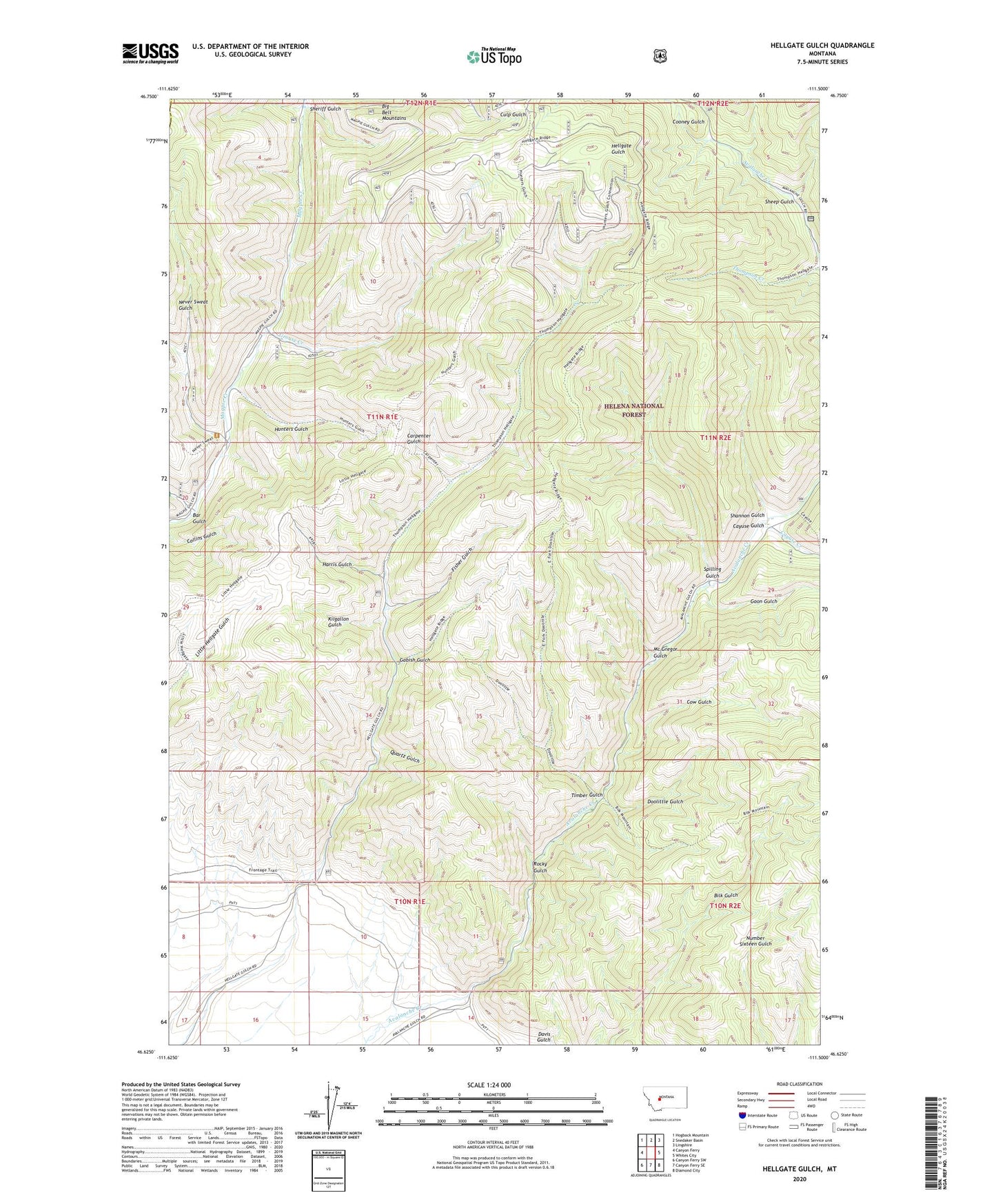
Hellgate Gulch Montana US Topo Map
Couldn't load pickup availability
Also explore the Hellgate Gulch Forest Service Topo of this same quad for updated USFS data
2024 topographic map quadrangle Hellgate Gulch in the state of Montana. Scale: 1:24000. Based on the newly updated USGS 7.5' US Topo map series, this map is in the following counties: Broadwater, Lewis and Clark. The map contains contour data, water features, and other items you are used to seeing on USGS maps, but also has updated roads and other features. This is the next generation of topographic maps. Printed on high-quality waterproof paper with UV fade-resistant inks.
Quads adjacent to this one:
West: Canyon Ferry
Northwest: Hogback Mountain
North: Snedaker Basin
Northeast: Lingshire
East: Whites City
Southeast: Diamond City
South: Canyon Ferry SE
Southwest: Canyon Ferry SW
This map covers the same area as the classic USGS quad with code o46111f5.
Contains the following named places: 10N01E14BACA01 Well, Argo Mine, Argo Post Office, Bar Gulch, Blackwells, Carpenter Gulch, Cayuse Creek, Cayuse Gulch, Cooney Gulch, Cow Gulch, Davis Gulch, Doolittle Gulch, Doolittle Gulch Mine, Fisher Gulch, Gabish Gulch, Goon Gulch, Grouse Creek, Harris Gulch, Hunters Gulch, Kilgallon Gulch, Mc Gregor Gulch, Never Sweat Gulch, Quartz Gulch, Rocky Gulch, Shannon Gulch, Sheep Gulch, Sheriff Gulch, Spilling Gulch, Thompson Creek Mine, Timber Gulch