MyTopo
Wise River Montana US Topo Map
Couldn't load pickup availability
Also explore the Wise River Forest Service Topo of this same quad for updated USFS data
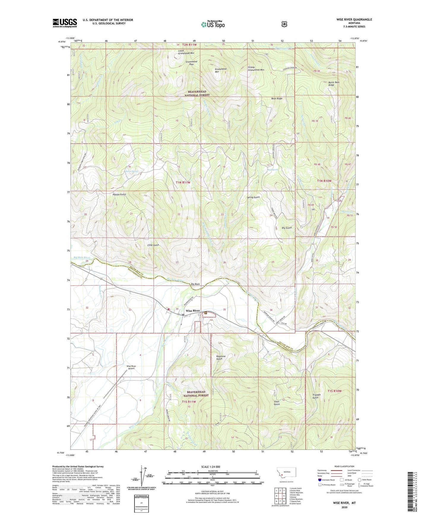
2024 topographic map quadrangle Wise River in the state of Montana. Scale: 1:24000. Based on the newly updated USGS 7.5' US Topo map series, this map is in the following counties: Silver Bow, Beaverhead. The map contains contour data, water features, and other items you are used to seeing on USGS maps, but also has updated roads and other features. This is the next generation of topographic maps. Printed on high-quality waterproof paper with UV fade-resistant inks.
Quads adjacent to this one:
West: Dickie Hills
Northwest: Lincoln Gulch
North: Dickie Peak
Northeast: Burnt Mountain
East: Dewey
Southeast: Cattle Gulch
South: Vipond Park
Southwest: Stine Mountain
This map covers the same area as the classic USGS quad with code o45112g8.
Contains the following named places: Bean Ridge, Big Rock, Burnt Dam Ridge, Church of the Big Hole, Cline Gulch, Deer Canyon Mine, Dodgson Creek, Dry Gulch, Granulated Creek, Granulated Mountain, Granulated Pass, Grassy Granulated Mountain, H-J Campground, Jerry Creek, Jerry Creek Airport, Jerry Creek Fishing Access, Jimmie New Creek, Keystone Gulch, Keystone Number 20 Mine, La Ducet Creek, Little Granulated Mountain, Meadow Creek, Moores Creek, Mud Spring, Patterson Corner, Patton Gulch, Patton Spring, SE NE Section 14 Mine, Spring Gulch, Spruce Creek, SW NE Section 25 Mine, Swamp Creek, Titan Gulch, Triangle Gulch, Triangle Gulch Mine, Triangle Gulch Number 2 Mine, West Fork Jimmie New Creek, Wise River, Wise River Airport, Wise River Census Designated Place, Wise River Club Campground, Wise River Elementary, Wise River Post Office, Wise River Ranger Station, Wise River Volunteer Fire Company