MyTopo
Dome Mountain Montana US Topo Map
Couldn't load pickup availability
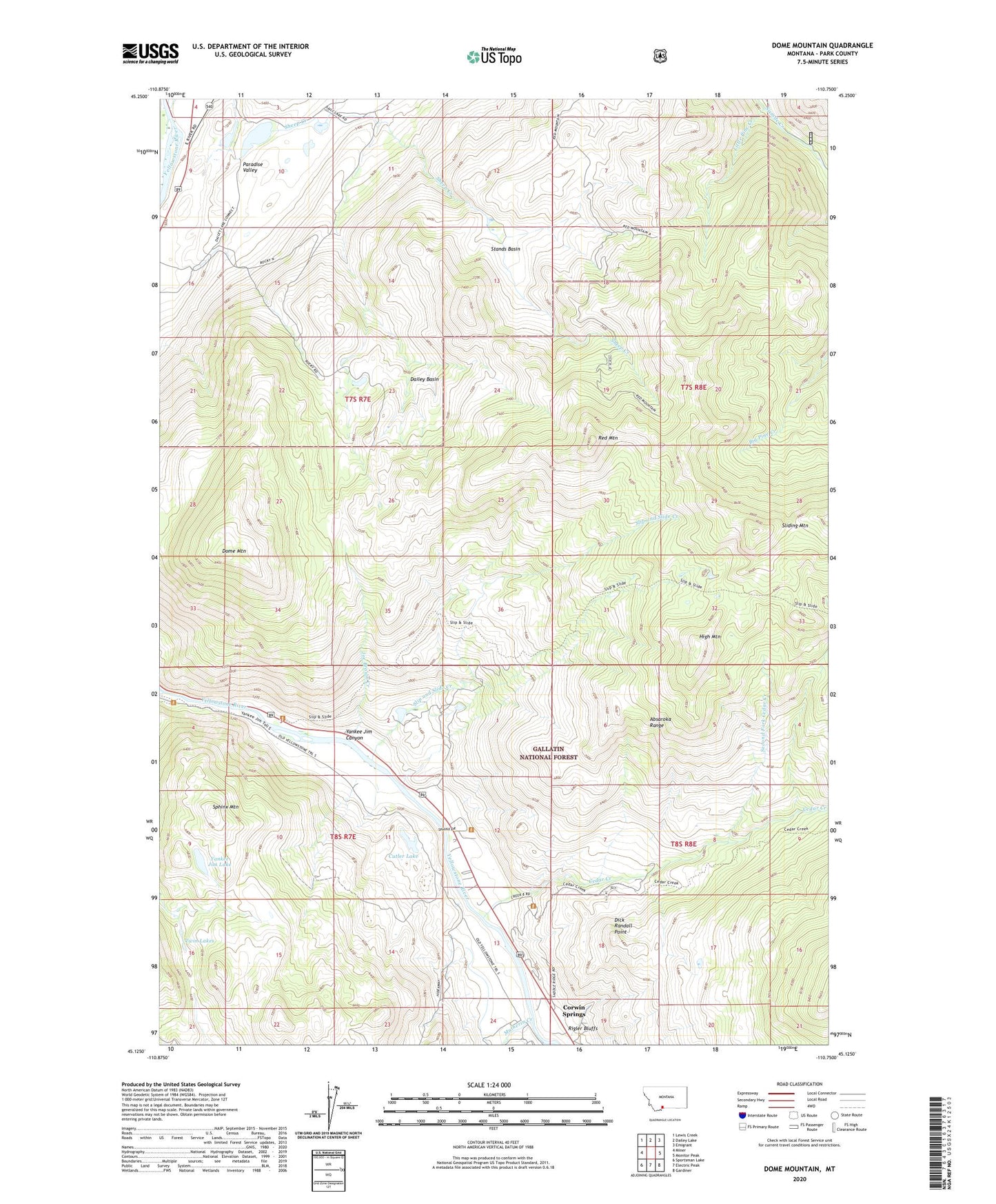
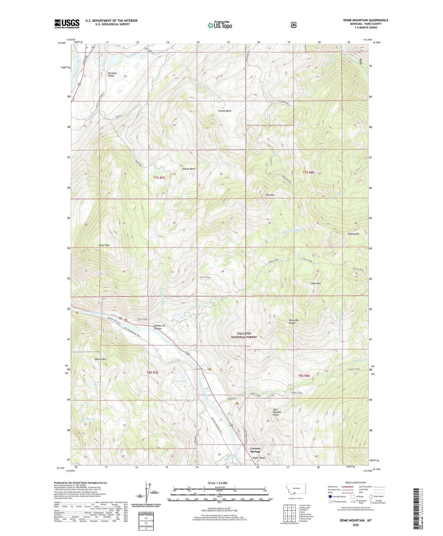
2020 topographic map quadrangle Dome Mountain in the state of Montana. Scale: 1:24000. Based on the newly updated USGS 7.5' US Topo map series, this map is in the following counties: Park. The map contains contour data, water features, and other items you are used to seeing on USGS maps, but also has updated roads and other features. This is the next generation of topographic maps. Printed on high-quality waterproof paper with UV fade-resistant inks.
Quads adjacent to this one:
West: Miner
Northwest: Lewis Creek
North: Dailey Lake
Northeast: Emigrant
East: Monitor Peak
Southeast: Gardiner
South: Electric Peak
Southwest: Sportsman Lake
Contains the following named places: Banana Peel Dam, Cedar Creek, Corwin Springs Census Designated Place, Cutler Lake, Dailey Basin, Dick Randall Point, Dome Mountain, Duderanch Post Office, High Mountain, Joe Brown Creek, Little Pine Creek, Mulherin, Mulherin Creek, OTO Ranch, Red Mountain, Rigler Bluffs, Second Fork Cedar Creek, Sheep Creek, Slip and Slide Creek, Slip and Slide Fishing Access Site, Sphinx Creek, Sphinx Mountain, Stands Basin, Thelma Number 1 Dam, Thelma Number 2 Dam, Thelma Number 3 Dam, Trestle Ranch, Twin Lakes, Yankee Jim Canyon Point of Interest, Yankee Jim Lake