MyTopo
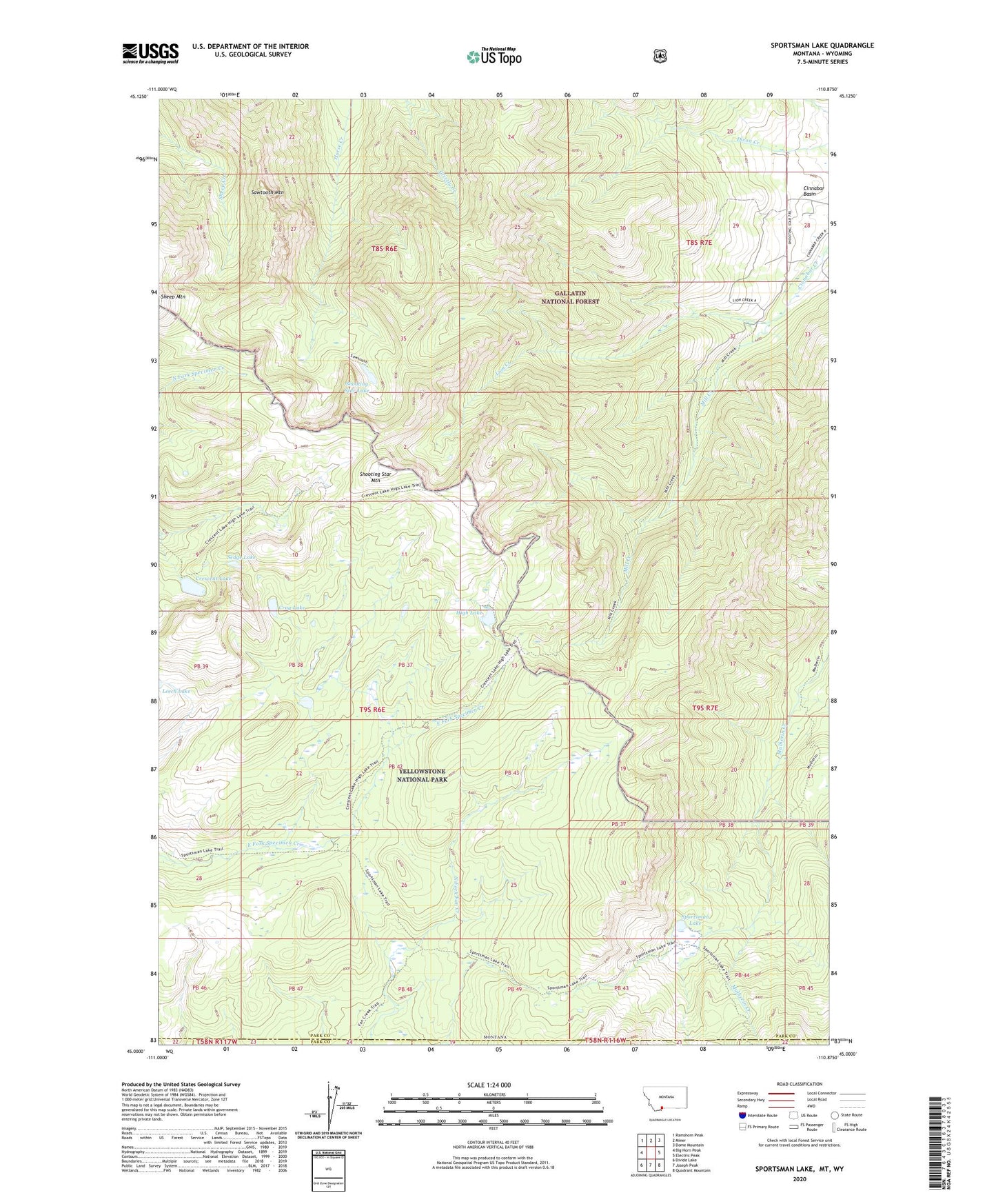
Sportsman Lake Montana US Topo Map
Couldn't load pickup availability
Also explore the Sportsman Lake Forest Service Topo of this same quad for updated USFS data
2024 topographic map quadrangle Sportsman Lake in the state of Montana. Scale: 1:24000. Based on the newly updated USGS 7.5' US Topo map series, this map is in the following counties: Park. The map contains contour data, water features, and other items you are used to seeing on USGS maps, but also has updated roads and other features. This is the next generation of topographic maps. Printed on high-quality waterproof paper with UV fade-resistant inks.
Quads adjacent to this one:
West: Big Horn Peak
Northwest: Ramshorn Peak
North: Miner
Northeast: Dome Mountain
East: Electric Peak
Southeast: Quadrant Mountain
South: Joseph Peak
Southwest: Divide Lake
Contains the following named places: Crag Lake, Crescent Lake, High Lake, Lion Creek, Mill Creek, Sawtooth Mountain, Sedge Lake, Shooting Star Lake, Shooting Star Mountain, Sportsman Lake, Sportsman Lake Trail, Sportsman Patrol Cabin, Yellowstone National Park County