MyTopo
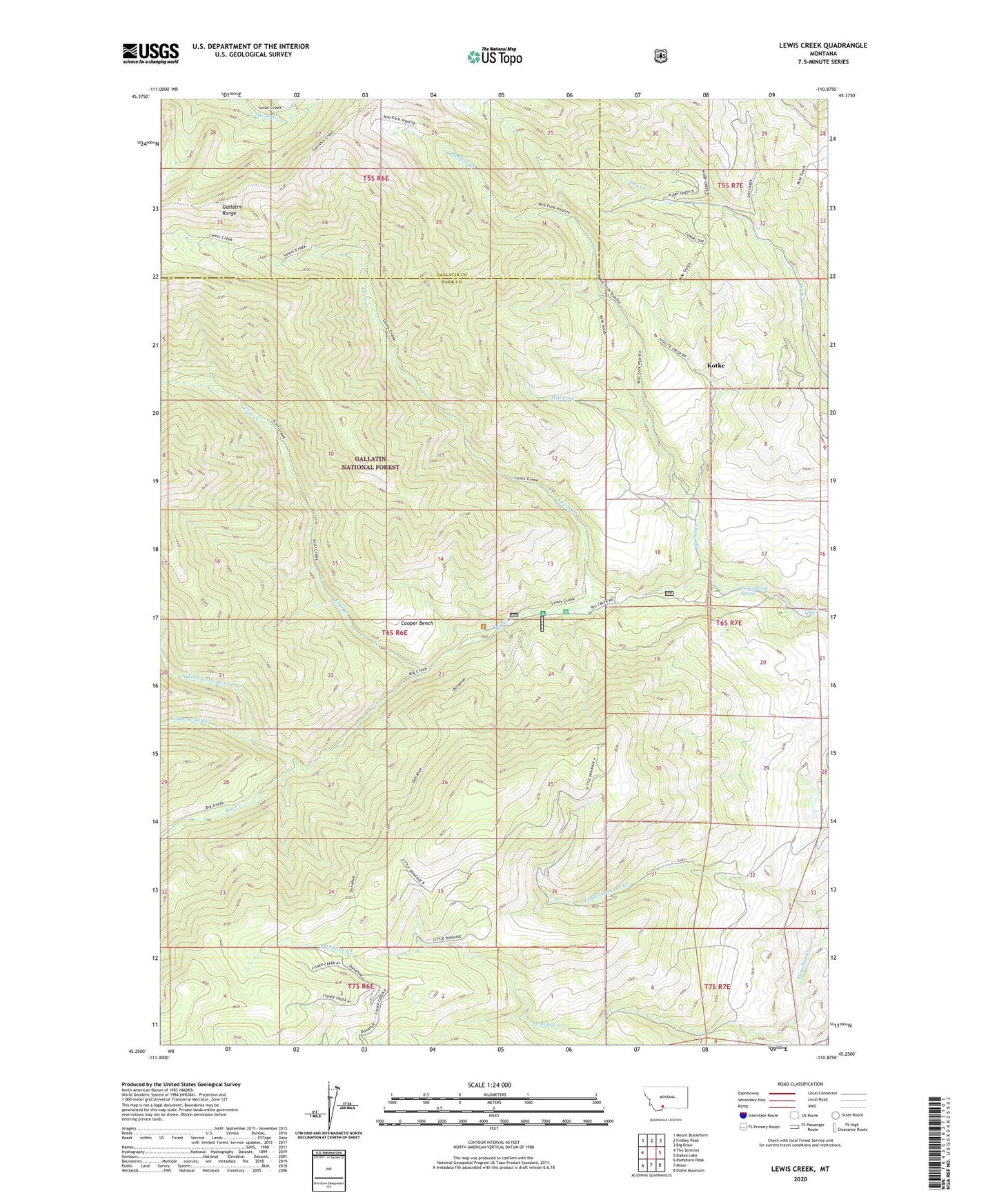
Lewis Creek Montana US Topo Map
Couldn't load pickup availability
Also explore the Lewis Creek Forest Service Topo of this same quad for updated USFS data
2024 topographic map quadrangle Lewis Creek in the state of Montana. Scale: 1:24000. Based on the newly updated USGS 7.5' US Topo map series, this map is in the following counties: Park, Gallatin. The map contains contour data, water features, and other items you are used to seeing on USGS maps, but also has updated roads and other features. This is the next generation of topographic maps. Printed on high-quality waterproof paper with UV fade-resistant inks.
Quads adjacent to this one:
West: The Sentinel
Northwest: Mount Blackmore
North: Fridley Peak
Northeast: Big Draw
East: Dailey Lake
Southeast: Dome Mountain
South: Miner
Southwest: Ramshorn Peak
This map covers the same area as the classic USGS quad with code o45110c8.
Contains the following named places: Big Creek Station, Cliff Creek, Cooper Bench, Cottonwood Creek, Hyalite Creek, Kotke, Lewis Creek, Middle Fork Cottonwood Creek, Mill Fork, North Fork Cottonwood Creek, Ox Yoke Ranch, Pole Gulch Trail, Red Rock Trail, Sunny Brook Spring