MyTopo
Donleys Reservoir Montana US Topo Map
Couldn't load pickup availability
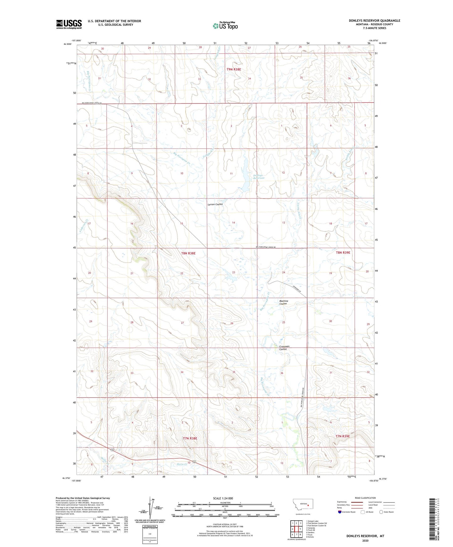
2024 topographic map quadrangle Donleys Reservoir in the state of Montana. Scale: 1:24000. Based on the newly updated USGS 7.5' US Topo map series, this map is in the following counties: Rosebud. The map contains contour data, water features, and other items you are used to seeing on USGS maps, but also has updated roads and other features. This is the next generation of topographic maps. Printed on high-quality waterproof paper with UV fade-resistant inks.
Quads adjacent to this one:
West: Vananda
Northwest: Zempel Lake
North: Flat Bottom Coulee SW
Northeast: Flat Bottom Coulee SE
East: Finch NE
Southeast: Nichols
South: Finch
Southwest: Sanders
This map covers the same area as the classic USGS quad with code o46106d8.
Contains the following named places: 08N38E20DC__01 Well, 08N38E24C___01 Well, Crossman Coulee, Donleys Reservoir, Donleys Reservoir Dam, East Fork Longfork Creek, Erickson Number 3 Dam, Erickson Number 4 Dam, French Number 10 Dam, French Number 9 Dam, Larson Coulee, Living Ash Creek, Longfork Creek, Machine Coulee, Miller School, Otis Post Office, T L Johnson Number 1 Dam, T L Johnson Number 5 Dam