MyTopo
Finch Montana US Topo Map
Couldn't load pickup availability
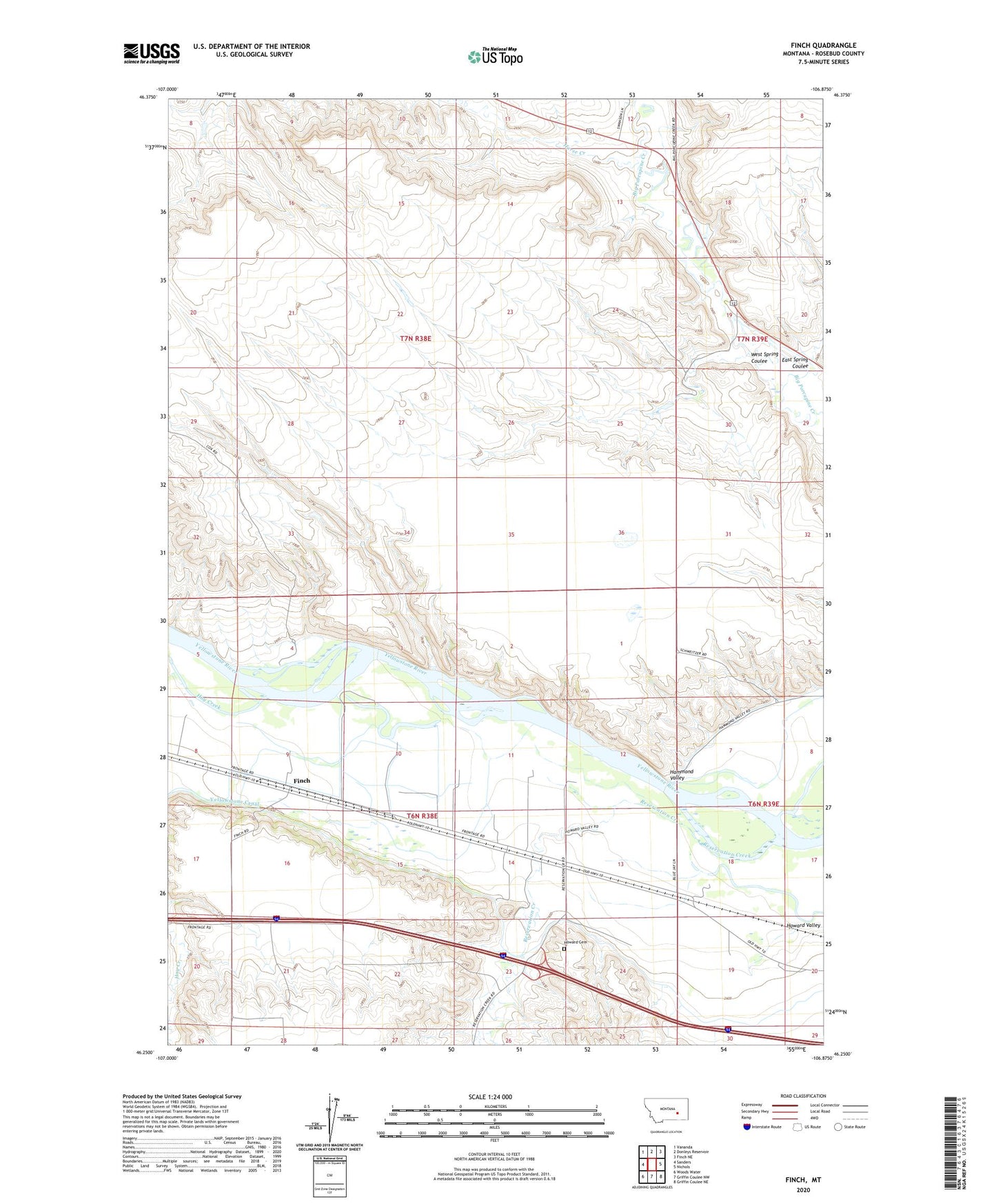
2024 topographic map quadrangle Finch in the state of Montana. Scale: 1:24000. Based on the newly updated USGS 7.5' US Topo map series, this map is in the following counties: Rosebud. The map contains contour data, water features, and other items you are used to seeing on USGS maps, but also has updated roads and other features. This is the next generation of topographic maps. Printed on high-quality waterproof paper with UV fade-resistant inks.
Quads adjacent to this one:
West: Sanders
Northwest: Vananda
North: Donleys Reservoir
Northeast: Finch NE
East: Nichols
Southeast: Griffin Coulee NE
South: Griffin Coulee NW
Southwest: Woods Water
This map covers the same area as the classic USGS quad with code o46106c8.
Contains the following named places: 06N38E08A___01 Well, 06N38E14C___01 Well, 06N38E17____01 Well, 06N39E18BCBC01 Well, 06N39E18C___01 Well, 06N39E19D___01 Well, Antwerp, East Spring Coulee, Finch, Finch Post Office, Finch School, Hay Creek, Horse Creek, Howard, Howard Cemetery, Howard Post Office, Howard School, Mace Church, Maudru Spur, Reservation Creek, South Vananda School, West Spring Coulee