MyTopo
Zempel Lake Montana US Topo Map
Couldn't load pickup availability
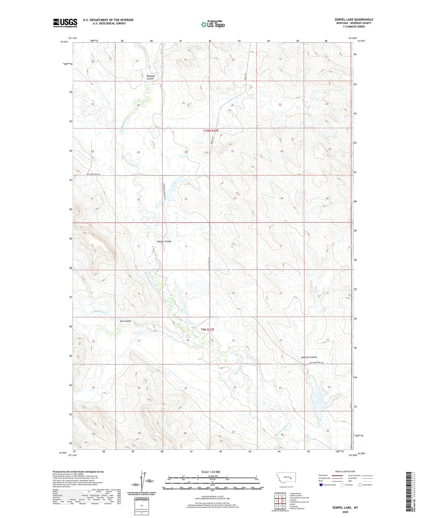
2024 topographic map quadrangle Zempel Lake in the state of Montana. Scale: 1:24000. Based on the newly updated USGS 7.5' US Topo map series, this map is in the following counties: Rosebud. The map contains contour data, water features, and other items you are used to seeing on USGS maps, but also has updated roads and other features. This is the next generation of topographic maps. Printed on high-quality waterproof paper with UV fade-resistant inks.
Quads adjacent to this one:
West: Thebes
Northwest: Hagen Ranch
North: Brown Coulee
Northeast: Flat Bottom Coulee NW
East: Flat Bottom Coulee SW
Southeast: Donleys Reservoir
South: Vananda
Southwest: Ahles
This map covers the same area as the classic USGS quad with code o46107e1.
Contains the following named places: Antelope Post Office, B G Olson Number 1 Dam, B G Olson Number 2 Dam, Badland Coulee, Davidell Post Office, E L Johnson Number 1 Dam, East Blacktail Creek, Hunnes Number 1 Dam, J Galt Number 10 Dam, J Galt Number 7 Dam, J Galt Number 8 Dam, Johnson Ranch, McGraw Coulee, Nelson Coulee, Nelson School, Olson Ranch, Richardson Dam, Richardson Ranch, Scott Lake School, Sun Coulee, West Blacktail Creek, Z Cake Dam, Zempel Dam, Zempel Lake, Zempel Ranch