MyTopo
Driveway Peak Montana US Topo Map
Couldn't load pickup availability
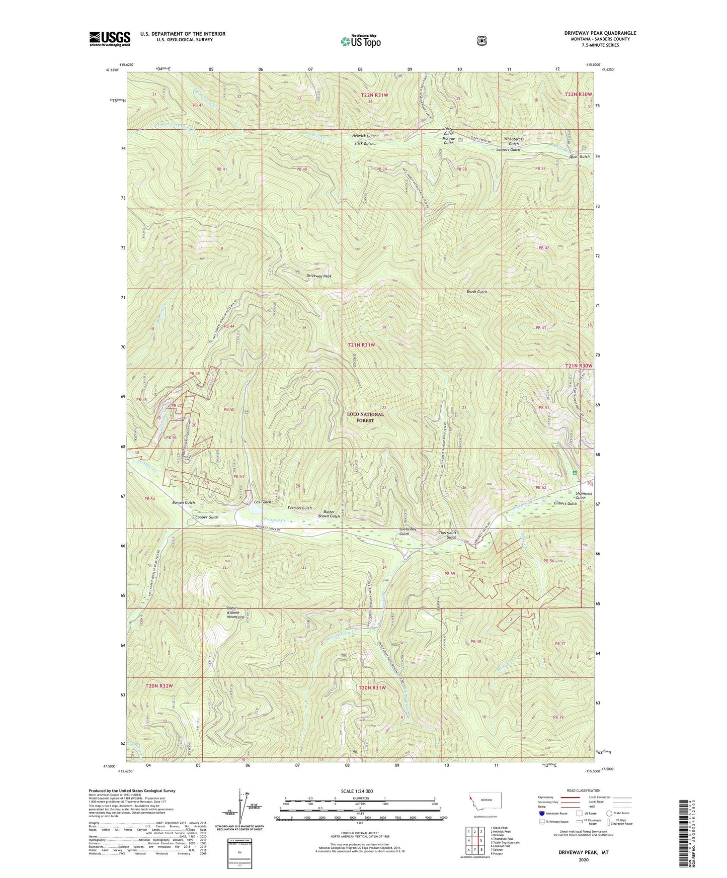
2020 topographic map quadrangle Driveway Peak in the state of Montana. Scale: 1:24000. Based on the newly updated USGS 7.5' US Topo map series, this map is in the following counties: Sanders. The map contains contour data, water features, and other items you are used to seeing on USGS maps, but also has updated roads and other features. This is the next generation of topographic maps. Printed on high-quality waterproof paper with UV fade-resistant inks.
Quads adjacent to this one:
West: Thompson Pass
Northwest: Black Peak
North: Helwick Peak
Northeast: Belknap
East: Table Top Mountain
Southeast: Haugan
South: Saltese
Southwest: Lookout Pass
Contains the following named places: Antimony Creek, Antimony Mine, Burson Gulch, Buster Brown Gulch, Cooper Gulch, Cox Gulch, Crow Creek, Daisy Creek, Dirty Gulch, Driveway Peak, East Fork Crow Creek, Everson Gulch, Gilbert Gulch, Helwick Gulch, Iron Daisy Mine, Looters Gulch, Lower Schwark Mine, Lucky Boy Gulch, Meadow Mountain/Tarbox Mine, Monroe Gulch, Montana City, Montana Mine, Montana Standard Mine, Mountain House Historic Site, North Fork Clear Creek, Prospect Creek Mine, Quail Gulch, Shamrock Gulch, Stick Gulch, Therriault Gulch, United States Forest Service Fire Station, Upper Fork Clear Creek, Upper Schwark Mine, West Fork Crow Creek, Wheatgrass Gulch