MyTopo
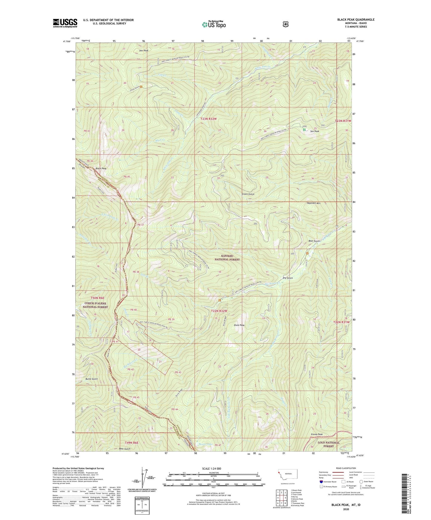
Black Peak Montana US Topo Map
Couldn't load pickup availability
Also explore the Black Peak Forest Service Topo of this same quad for updated USFS data
2024 topographic map quadrangle Black Peak in the states of Idaho, Montana. Scale: 1:24000. Based on the newly updated USGS 7.5' US Topo map series, this map is in the following counties: Sanders, Shoshone. The map contains contour data, water features, and other items you are used to seeing on USGS maps, but also has updated roads and other features. This is the next generation of topographic maps. Printed on high-quality waterproof paper with UV fade-resistant inks.
Quads adjacent to this one:
West: Murray
Northwest: Bloom Peak
North: Larchwood
Northeast: Trout Creek
East: Helwick Peak
Southeast: Driveway Peak
South: Thompson Pass
Southwest: Burke
This map covers the same area as the classic USGS quad with code o47115f6.
Contains the following named places: Bear Gulch, Beaver Lake, Black Creek, Black Peak, Chute Creek, Cole Creek, Cub Creek, Dixie Creek, Dixie Peak, Dragin Creek, Dry Gulch, Duthie, Emma Peak, Emma Peak Pack Trail, Haystack Mountain, Jack Pine Flats Campground, Jack Waite Mine, Jew Peak, Lost Branch, Ripper Creek, Sex Peak, Sex Peak Lookout Station, South Branch Big Beaver Creek, Woodchuck Creek