MyTopo
Haugan Montana US Topo Map
Couldn't load pickup availability
Also explore the Haugan Forest Service Topo of this same quad for updated USFS data
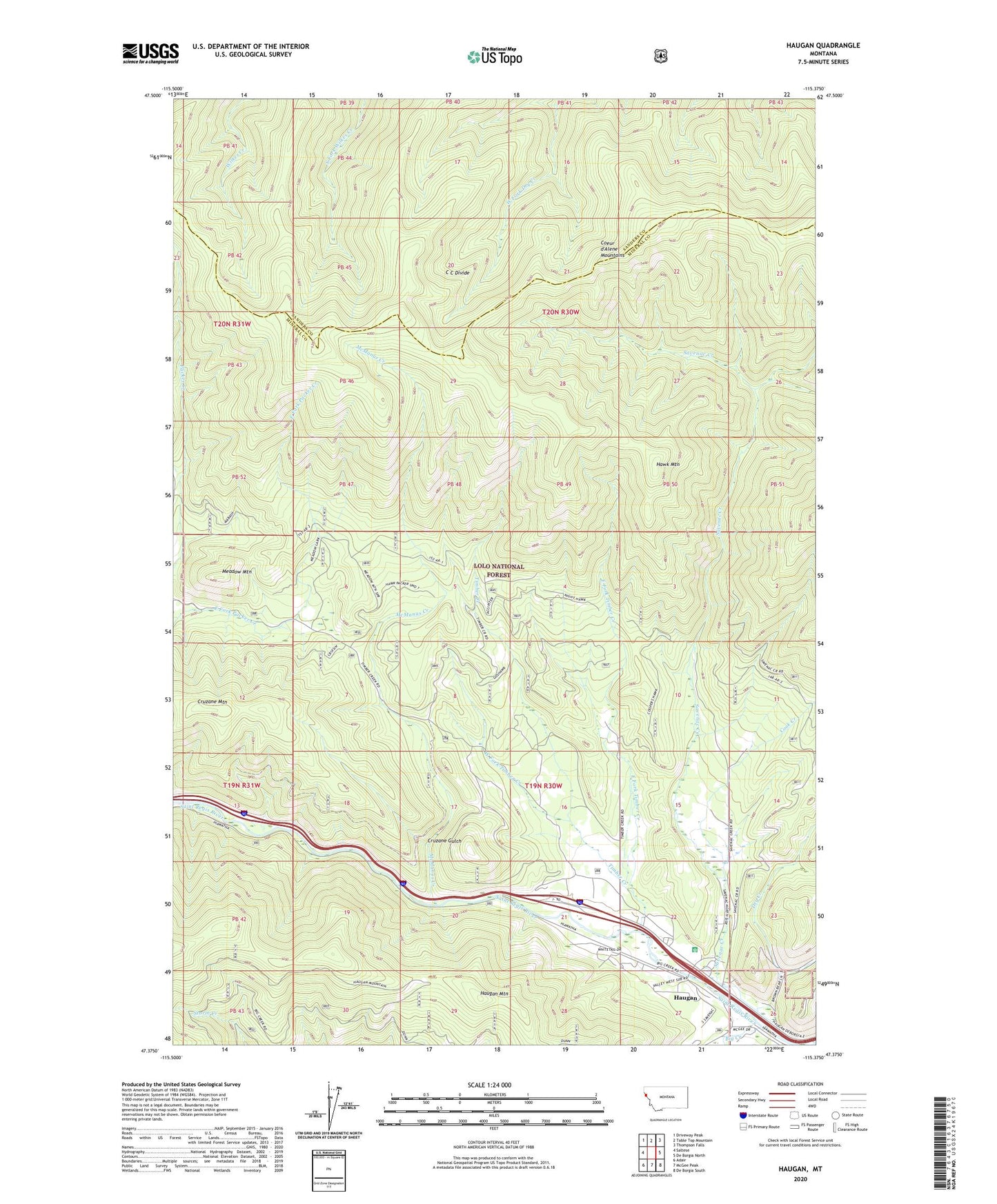
2024 topographic map quadrangle Haugan in the state of Montana. Scale: 1:24000. Based on the newly updated USGS 7.5' US Topo map series, this map is in the following counties: Mineral, Sanders. The map contains contour data, water features, and other items you are used to seeing on USGS maps, but also has updated roads and other features. This is the next generation of topographic maps. Printed on high-quality waterproof paper with UV fade-resistant inks.
Quads adjacent to this one:
West: Saltese
Northwest: Driveway Peak
North: Table Top Mountain
Northeast: Thompson Falls
East: De Borgia North
Southeast: De Borgia South
South: McGee Peak
Southwest: Adair
This map covers the same area as the classic USGS quad with code o47115d4.
Contains the following named places: Big Creek, Black Traveler Mine, Cook Creek, Cruzane Gulch, Cruzane Mountain, Dry Creek, East Coeur D'Alene Mine, East Fork Packer Creek, East Fork Pass, East Fork Timber Creek, Haugan, Haugan Census Designated Place, Haugan Mountain, Haugan Post Office, Haugan School, Hawk Mountain, Hougan, Last Chance Mine, McGee Creek, McManus Creek, Meadow Mountain, Meadow Mountain Mine, Middle Fork Savanac Creek, Milroy, Queen Bee Mine, Saltese Consolidated Mine, Savenac Creek, Savenac Nursery, Silver Dollar Inn Campground, Storm Peak Trail, Tarbox Mine, Tarbox-Mineral King Mine, Timber Creek, Wabash Mine, Wence, West Fork Timber Creek, Wileys