MyTopo
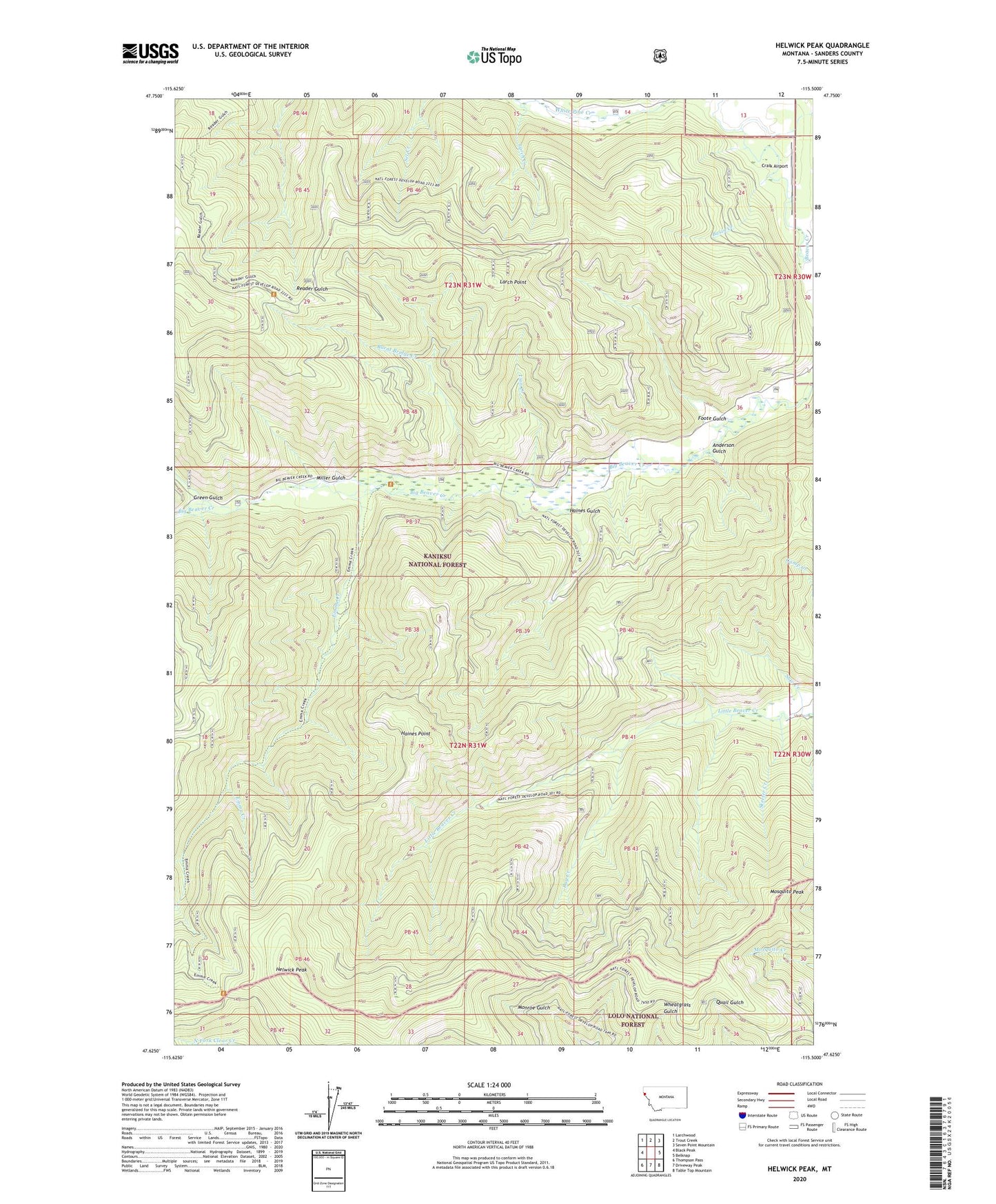
Helwick Peak Montana US Topo Map
Couldn't load pickup availability
Also explore the Helwick Peak Forest Service Topo of this same quad for updated USFS data
2024 topographic map quadrangle Helwick Peak in the state of Montana. Scale: 1:24000. Based on the newly updated USGS 7.5' US Topo map series, this map is in the following counties: Sanders. The map contains contour data, water features, and other items you are used to seeing on USGS maps, but also has updated roads and other features. This is the next generation of topographic maps. Printed on high-quality waterproof paper with UV fade-resistant inks.
Quads adjacent to this one:
West: Black Peak
Northwest: Larchwood
North: Trout Creek
Northeast: Seven Point Mountain
East: Belknap
Southeast: Table Top Mountain
South: Driveway Peak
Southwest: Thompson Pass
This map covers the same area as the classic USGS quad with code o47115f5.
Contains the following named places: Anderson Gulch, Basin Creek, Bug Creek, Burnt Bridge Creek, Craik Airport, Emma Creek, Foote Gulch, Green Gulch, Haines Gulch, Haines Point, Helwick Peak, Larch Creek, Larch Point, Lion Creek, Miller Gulch, Mosquito Peak, Reader Gulch Pack Trail, Saw Creek, Skeeter Creek