MyTopo
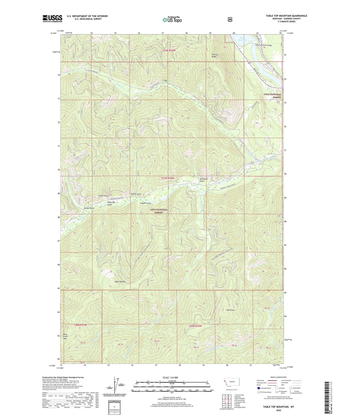
Table Top Mountain Montana US Topo Map
Couldn't load pickup availability
Also explore the Table Top Mountain Forest Service Topo of this same quad for updated USFS data
2024 topographic map quadrangle Table Top Mountain in the state of Montana. Scale: 1:24000. Based on the newly updated USGS 7.5' US Topo map series, this map is in the following counties: Sanders. The map contains contour data, water features, and other items you are used to seeing on USGS maps, but also has updated roads and other features. This is the next generation of topographic maps. Printed on high-quality waterproof paper with UV fade-resistant inks.
Quads adjacent to this one:
West: Driveway Peak
Northwest: Helwick Peak
North: Belknap
Northeast: Mount Headley
East: Thompson Falls
Southeast: De Borgia North
South: Haugan
Southwest: Saltese
This map covers the same area as the classic USGS quad with code o47115e4.
Contains the following named places: 21N30W14AAAD01 Well, Birdland Bay RV Resort, Brush Gulch, Clark Fork River Bridge, Clear Creek, Coyote Gulch, Daisy Creek Pass, Flatiron Ridge, Foster Gulch, Hill Seven, Joan Creek, Pinehurst, Shorty Gulch, South Fork Wilkes Creek, Table Top Gulch, Table Top Mountain, Thompson Falls Campground, Thompson Falls State Park Campground, Thompson Falls State Recreation Area, Valentine Gulch, Wilkes Creek