MyTopo
Duckhead Buttes Montana US Topo Map
Couldn't load pickup availability
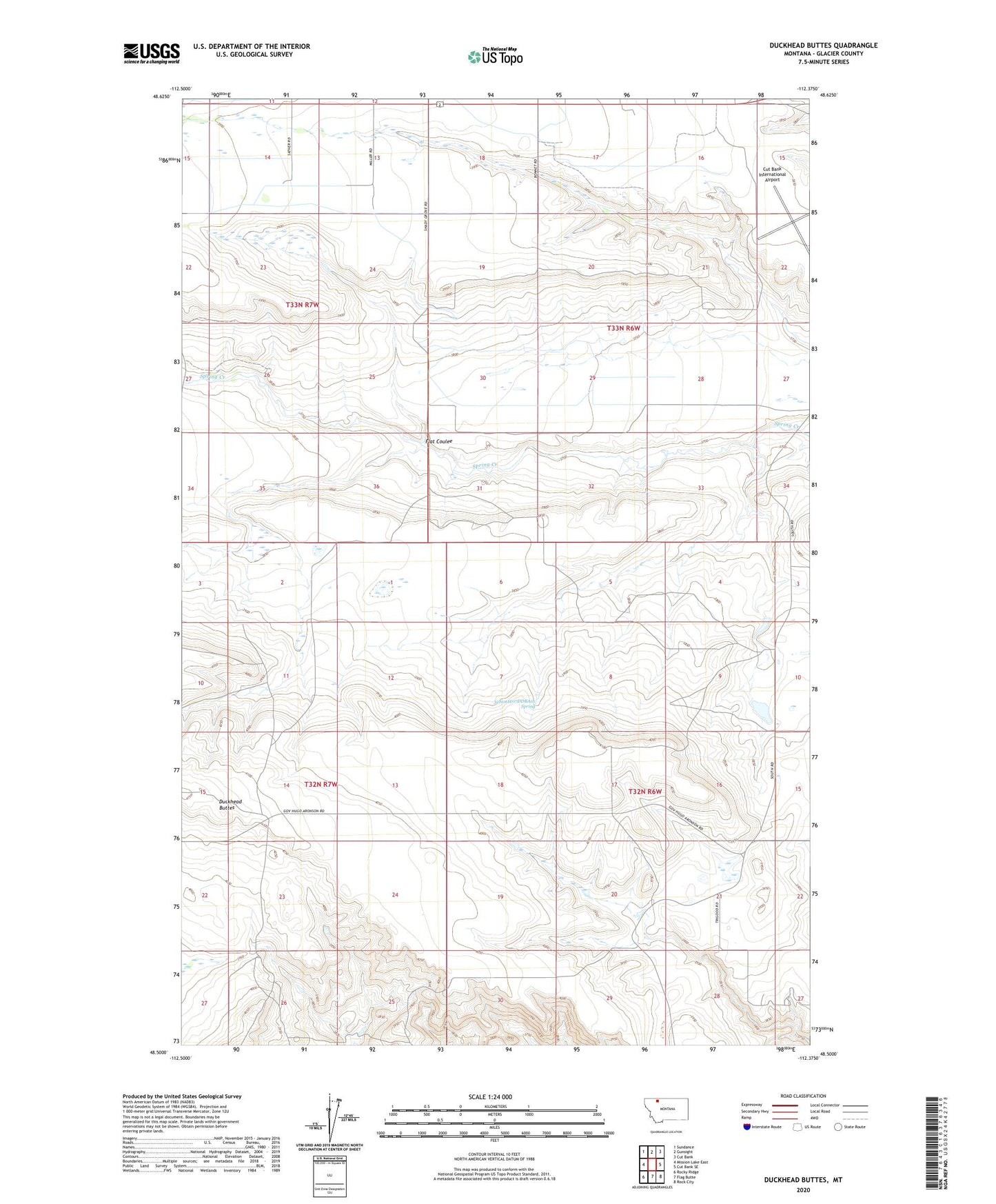
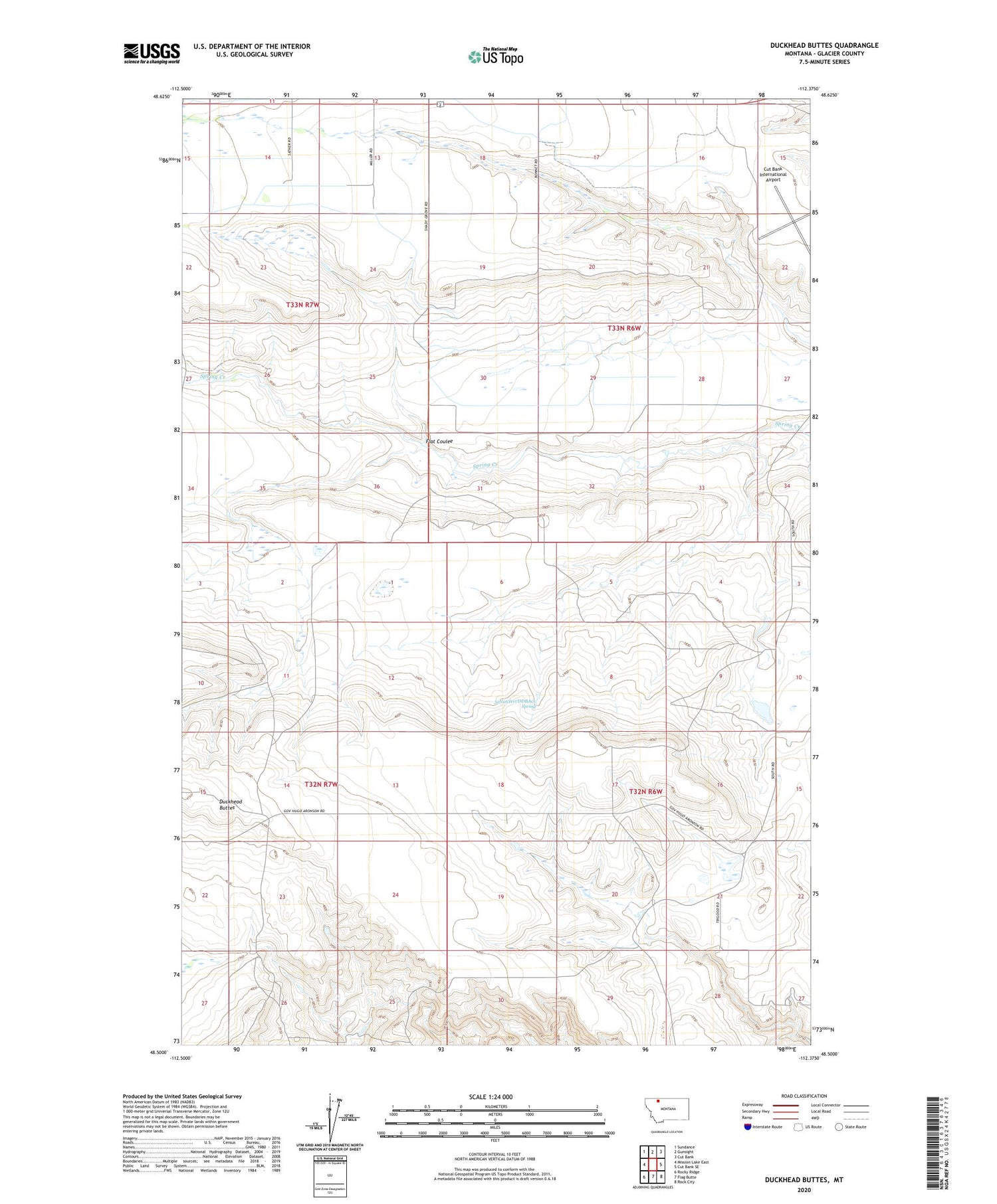
2020 topographic map quadrangle Duckhead Buttes in the state of Montana. Scale: 1:24000. Based on the newly updated USGS 7.5' US Topo map series, this map is in the following counties: Glacier. The map contains contour data, water features, and other items you are used to seeing on USGS maps, but also has updated roads and other features. This is the next generation of topographic maps. Printed on high-quality waterproof paper with UV fade-resistant inks.
Quads adjacent to this one:
West: Mission Lake East
Northwest: Sundance
North: Gunsight
Northeast: Cut Bank
East: Cut Bank SE
Southeast: Rock City
South: Flag Butte
Southwest: Rocky Ridge
Contains the following named places: 32N06W07DDBA01 Spring, 33N06W16AA__01 Well, Cut Bank Army Air Field, Flat Coulee, Shady Grove Campground