MyTopo
East Glacier Park Montana US Topo Map
Couldn't load pickup availability
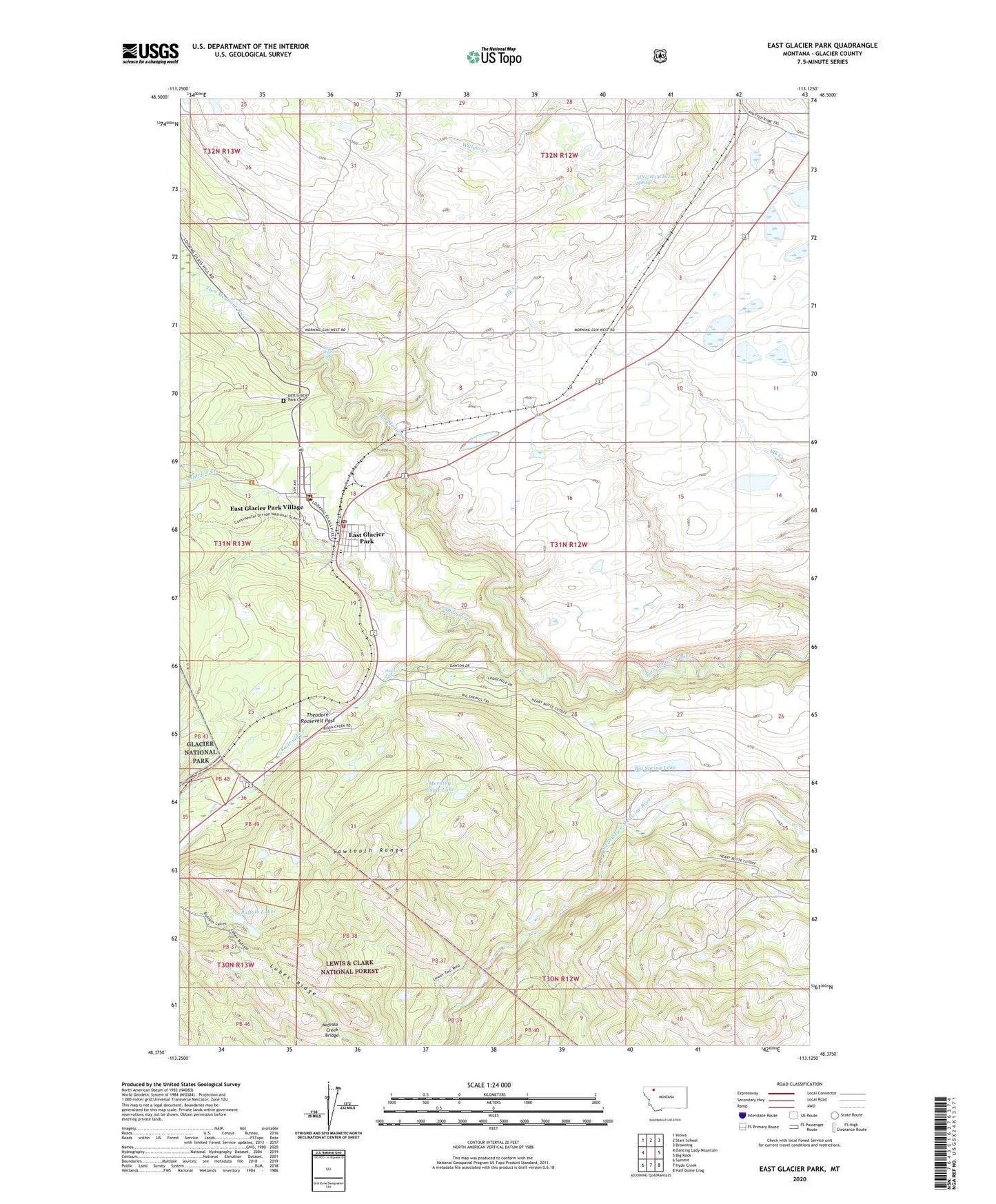
2020 topographic map quadrangle East Glacier Park in the state of Montana. Scale: 1:24000. Based on the newly updated USGS 7.5' US Topo map series, this map is in the following counties: Glacier. The map contains contour data, water features, and other items you are used to seeing on USGS maps, but also has updated roads and other features. This is the next generation of topographic maps. Printed on high-quality waterproof paper with UV fade-resistant inks.
Quads adjacent to this one:
West: Dancing Lady Mountain
Northwest: Kiowa
North: Starr School
Northeast: Browning
East: Big Rock
Southeast: Half Dome Crag
South: Hyde Creek
Southwest: Summit
Contains the following named places: 32N12W34CBCD01 Spring, Big Spring Lake, Bison Creek Ranch, Buffalo Lakes, Chapel of the Ascension, Dawson Falls, East Glacier Park, East Glacier Park Branch Library, East Glacier Park Cemetery, East Glacier Park Post Office, East Glacier Park School, East Glacier Park Village, East Glacier Park Village Census Designated Place, East Glacier Park Volunteer Fire Department, Elk, Firebrand Campground, Glacier Park, Glacier Park Lodge Golf Course, Lubec Ridge, Midvale Creek, Midvale Creek Bridge, Morning Eagle Lake, Railroad Creek, Sears Motel and Campground, Smileys RV Park, Spotted Robe, Two Medicine Falls, Y Lazy R RV Park