MyTopo
Kiowa Montana US Topo Map
Couldn't load pickup availability
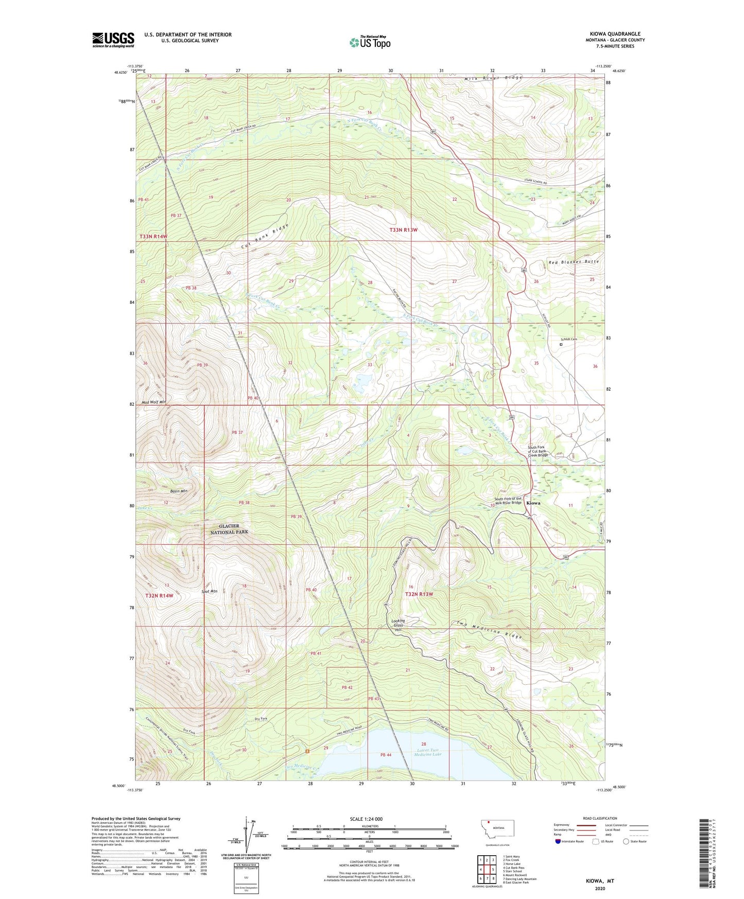
2024 topographic map quadrangle Kiowa in the state of Montana. Scale: 1:24000. Based on the newly updated USGS 7.5' US Topo map series, this map is in the following counties: Glacier. The map contains contour data, water features, and other items you are used to seeing on USGS maps, but also has updated roads and other features. This is the next generation of topographic maps. Printed on high-quality waterproof paper with UV fade-resistant inks.
Quads adjacent to this one:
West: Cut Bank Pass
Northwest: Saint Mary
North: Fox Creek
Northeast: Horse Lake
East: Starr School
Southeast: East Glacier Park
South: Dancing Lady Mountain
Southwest: Mount Rockwell
This map covers the same area as the classic USGS quad with code o48113e3.
Contains the following named places: Basin Mountain, Boundary Trail, Cut Bank Ridge, Dry Fork Trail, Kiowa, Lake Creek, Looking Glass Hill, Lower Two Medicine Lake, Mad Wolf Mountain, Red Blanket Butte, Schildt Cemetery, South Fork of Cut Bank Creek Bridge, South Fork of the Milk River Bridge, Spot Mountain, Two Medicine Creek, Two Medicine Ridge