MyTopo
Dancing Lady Mountain Montana US Topo Map
Couldn't load pickup availability
Also explore the Dancing Lady Mountain Forest Service Topo of this same quad for updated USFS data
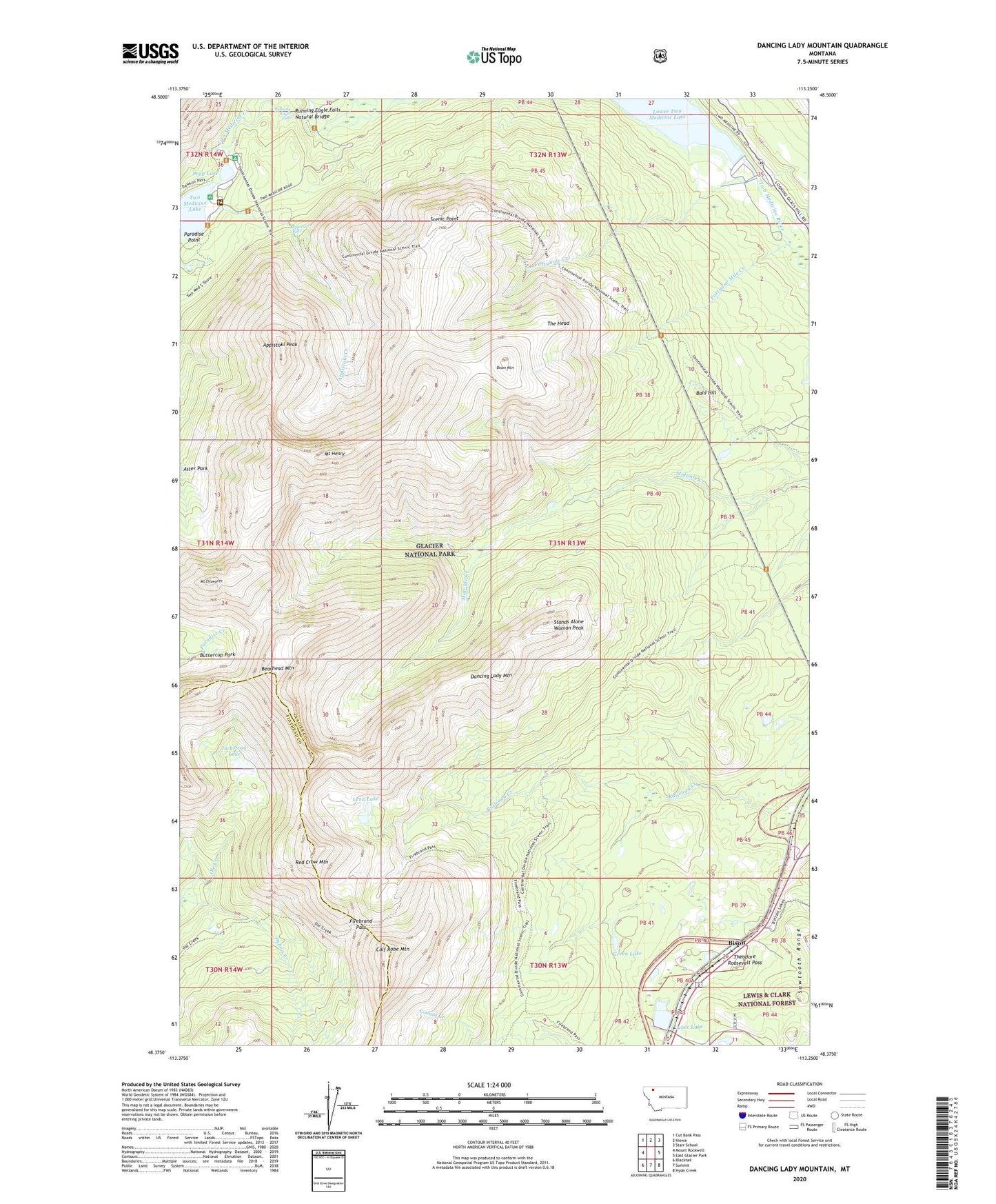
2024 topographic map quadrangle Dancing Lady Mountain in the state of Montana. Scale: 1:24000. Based on the newly updated USGS 7.5' US Topo map series, this map is in the following counties: Glacier, Flathead. The map contains contour data, water features, and other items you are used to seeing on USGS maps, but also has updated roads and other features. This is the next generation of topographic maps. Printed on high-quality waterproof paper with UV fade-resistant inks.
Quads adjacent to this one:
West: Mount Rockwell
Northwest: Cut Bank Pass
North: Kiowa
Northeast: Starr School
East: East Glacier Park
Southeast: Hyde Creek
South: Summit
Southwest: Blacktail
Contains the following named places: Appistoki Creek, Appistoki Falls, Appistoki Peak, Aster Park, Bald Hill, Bearhead Mountain, Bison, Bison Mountain, Buttercup Park, Calf Robe Mountain, Dancing Lady Mountain, Debris Creek, Dry Fork, Firebrand Pass, Firebrand Pass Trail, Fortymile Creek, Fortyone Mile Creek, Glacier Park Autumn Creek Trail, Green Lake, Jackstraw Lake, Lena Lake, Lower Two Medicine Dam, Lubec Lake, Mount Ellsworth, Mount Henry, Mount Henry Trail, Ole Creek Trail, Pray Lake, Red Crow Mountain, Red Eagle-Two Medicine Campground, Running Eagle Falls, Running Eagle Falls Natural Bridge, Scenic Point, Stands Alone Woman Peak, The Head, Two Medicine Campground, ZIP Code: 59434