MyTopo
East Pryor Mountain Montana US Topo Map
Couldn't load pickup availability
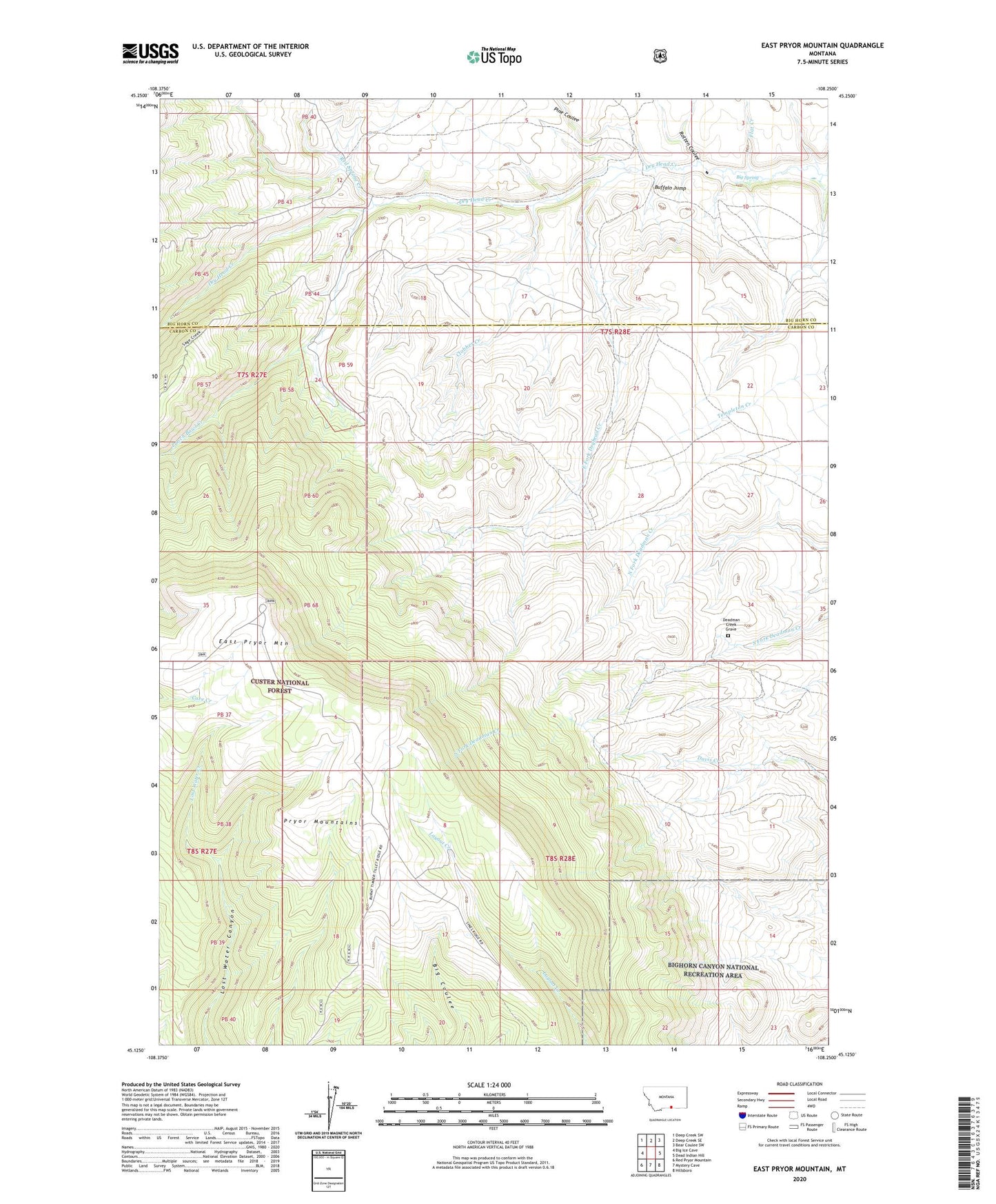
2020 topographic map quadrangle East Pryor Mountain in the state of Montana. Scale: 1:24000. Based on the newly updated USGS 7.5' US Topo map series, this map is in the following counties: Carbon, Big Horn. The map contains contour data, water features, and other items you are used to seeing on USGS maps, but also has updated roads and other features. This is the next generation of topographic maps. Printed on high-quality waterproof paper with UV fade-resistant inks.
Quads adjacent to this one:
West: Big Ice Cave
Northwest: Deep Creek SW
North: Deep Creek SE
Northeast: Bear Coulee SW
East: Dead Indian Hill
Southeast: Hillsboro
South: Mystery Cave
Southwest: Red Pryor Mountain
Contains the following named places: Big Spring, Buffalo Jump, Clabber Creek, Deadman Creek Grave, Dry Head Ranch, Dry Head Vista, Dryhead, Dryhead Post Office, East Fork Dryhead Creek, East Pryor Mountain, Flat Creek, Pine Coulee, Punch Bowl Creek, Red Spring Creek, Rotten Coulee