MyTopo
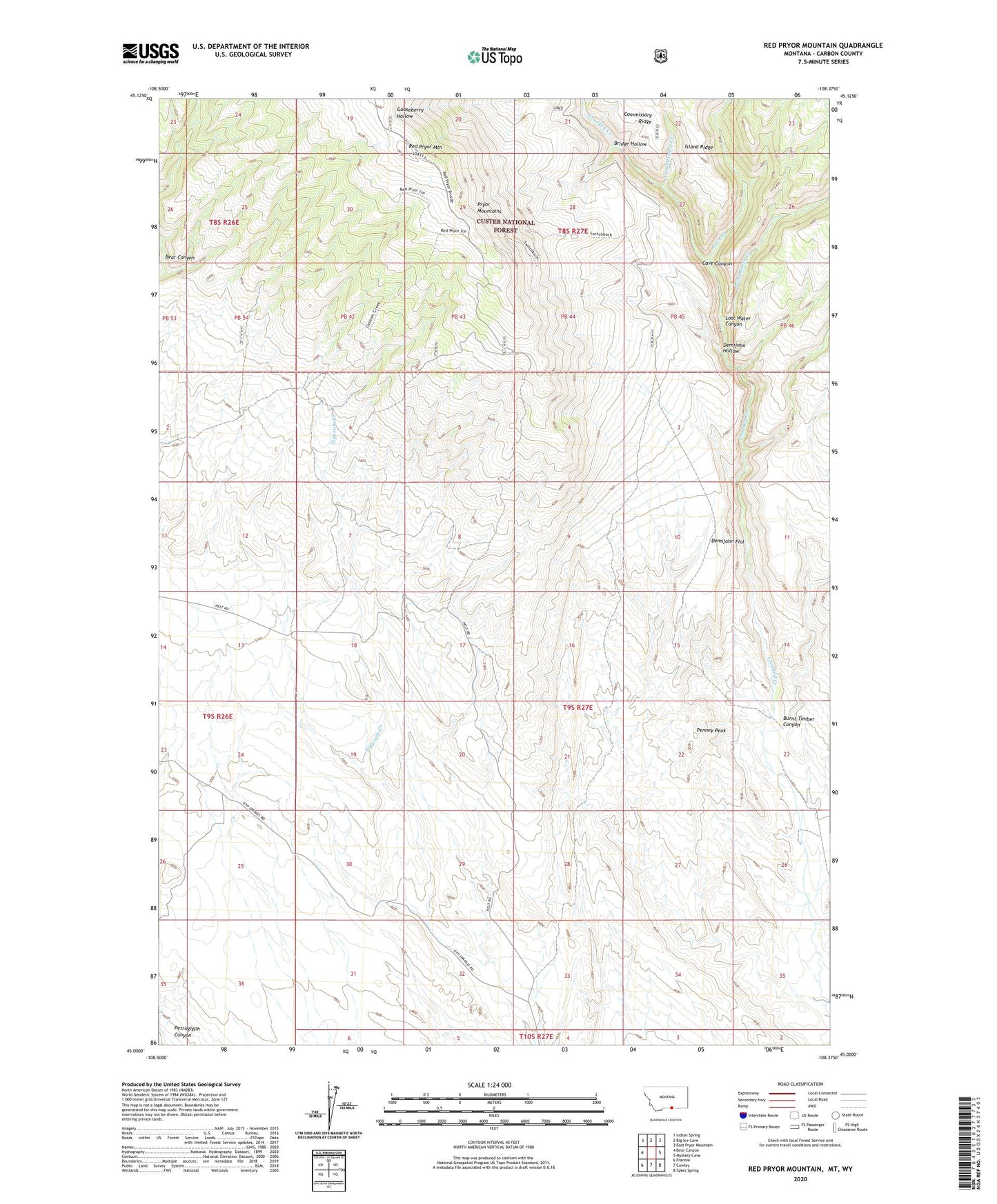
Red Pryor Mountain Montana US Topo Map
Couldn't load pickup availability
Also explore the Red Pryor Mountain Forest Service Topo of this same quad for updated USFS data
2024 topographic map quadrangle Red Pryor Mountain in the state of Montana. Scale: 1:24000. Based on the newly updated USGS 7.5' US Topo map series, this map is in the following counties: Carbon, Big Horn. The map contains contour data, water features, and other items you are used to seeing on USGS maps, but also has updated roads and other features. This is the next generation of topographic maps. Printed on high-quality waterproof paper with UV fade-resistant inks.
Quads adjacent to this one:
West: Bear Canyon
Northwest: Indian Spring
North: Big Ice Cave
Northeast: East Pryor Mountain
East: Mystery Cave
Southeast: Sykes Spring
South: Cowley
Southwest: Frannie
Contains the following named places: Bridge Hollow, Burnt Timber Canyon, Cave Canyon, Cave Creek, CM and M Pit, Commissary Creek, Dandy Mine, Demijohn Flat, Demijohn Hollow, Lisbon Mine, Lost Water Canyon, Lost Water Creek, Marie Mine, Old Glory Mine, Penney Peak, Red Pryor Mountain, Red Water Well, Roberts Incline Mine, Sandra Mine, SW SW Section 4 Mine, Swamp Frog Mine, Teepee Rings, The Dandy Mine, Tillett Ranch