MyTopo
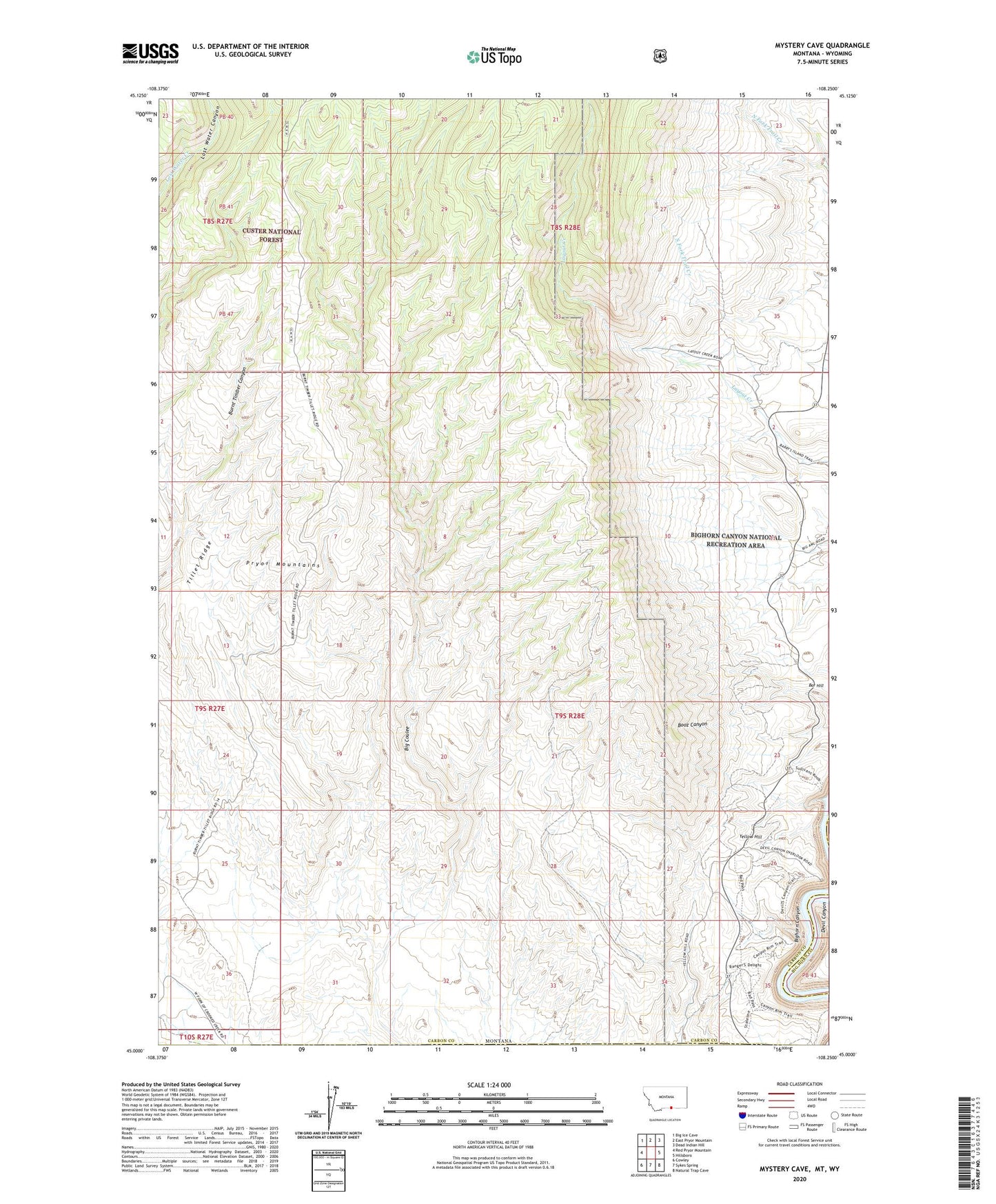
Mystery Cave Montana US Topo Map
Couldn't load pickup availability
Also explore the Mystery Cave Forest Service Topo of this same quad for updated USFS data
2024 topographic map quadrangle Mystery Cave in the state of Montana. Scale: 1:24000. Based on the newly updated USGS 7.5' US Topo map series, this map is in the following counties: Carbon, Big Horn. The map contains contour data, water features, and other items you are used to seeing on USGS maps, but also has updated roads and other features. This is the next generation of topographic maps. Printed on high-quality waterproof paper with UV fade-resistant inks.
Quads adjacent to this one:
West: Red Pryor Mountain
Northwest: Big Ice Cave
North: East Pryor Mountain
Northeast: Dead Indian Hill
East: Hillsboro
Southeast: Natural Trap Cave
South: Sykes Spring
Southwest: Cowley
Contains the following named places: Bar Hill, Devils Canyon Overlook, Ewing Post Office, Layout Creek Ranger Station, Pryor Mountain Wild Horse Range, Tillet Ridge, Wild Horse Mine, Yellow Hill