MyTopo
Eddy Mountain Montana US Topo Map
Couldn't load pickup availability
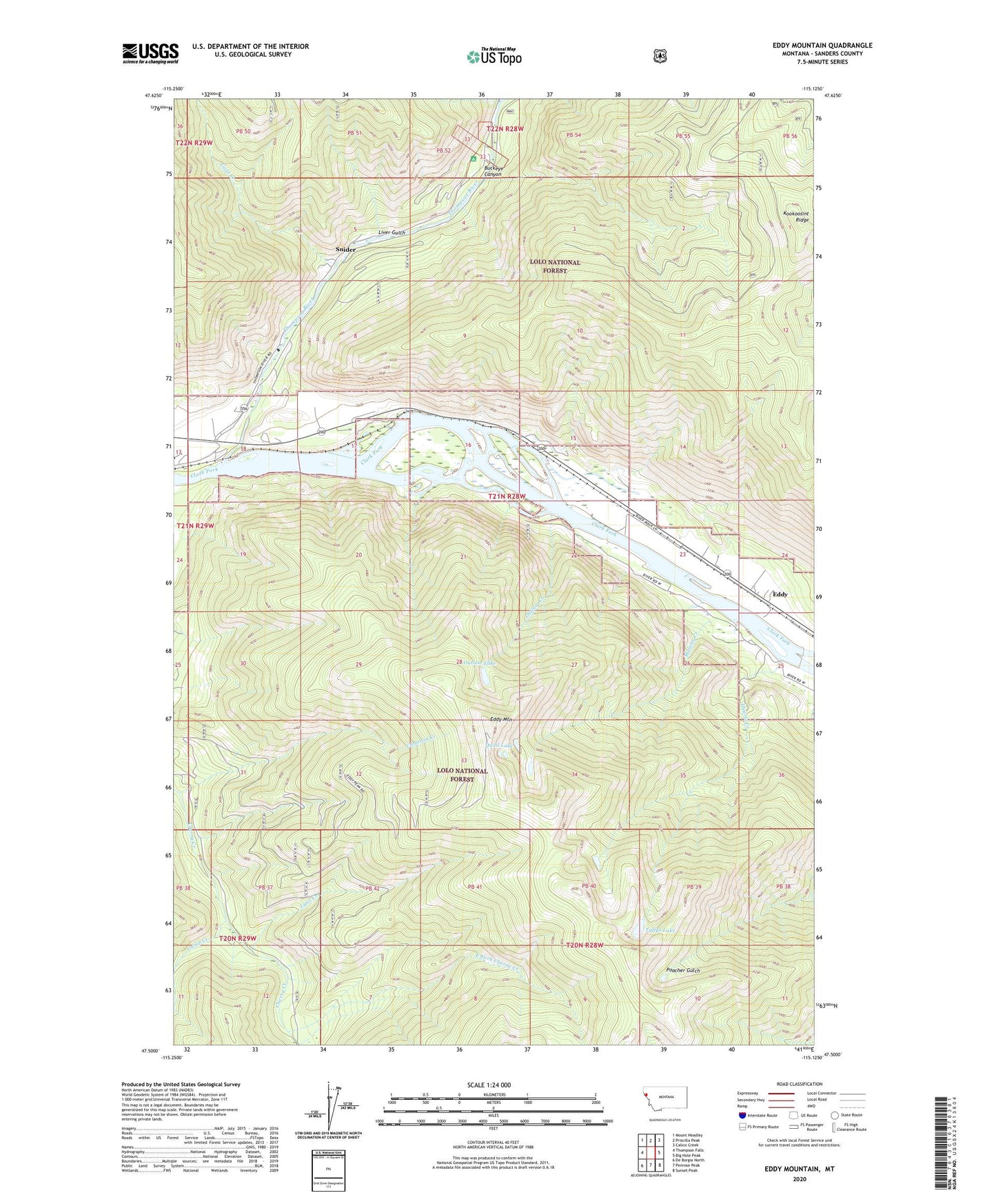
2020 topographic map quadrangle Eddy Mountain in the state of Montana. Scale: 1:24000. Based on the newly updated USGS 7.5' US Topo map series, this map is in the following counties: Sanders. The map contains contour data, water features, and other items you are used to seeing on USGS maps, but also has updated roads and other features. This is the next generation of topographic maps. Printed on high-quality waterproof paper with UV fade-resistant inks.
Quads adjacent to this one:
West: Thompson Falls
Northwest: Mount Headley
North: Priscilla Peak
Northeast: Calico Creek
East: Big Hole Peak
Southeast: Sunset Peak
South: Penrose Peak
Southwest: De Borgia North
Contains the following named places: Ashleys Settlement, Buckeye Canyon, Cameron Creek, Camp Creek, Copper King Campground, Copper King Mine, East Fork Cherry Creek, Eddy, Eddy Mountain, Eddy Post Office, Eddy School, Frost, Goat Creek, Kookoosint Ridge, Liver Gulch, Lower Raven Mine, Lower Silver King Mine, Lynx Creek, Malone Creek, Outlaw Creek, Outlaw Lake, Quail Lake, Quartz Creek, Raven Mine, Silver King Mine, Snider, Snider Post Office, Thompson River, Thompson River Spur, Thompsons River Post Office, Tuffys Lake