MyTopo
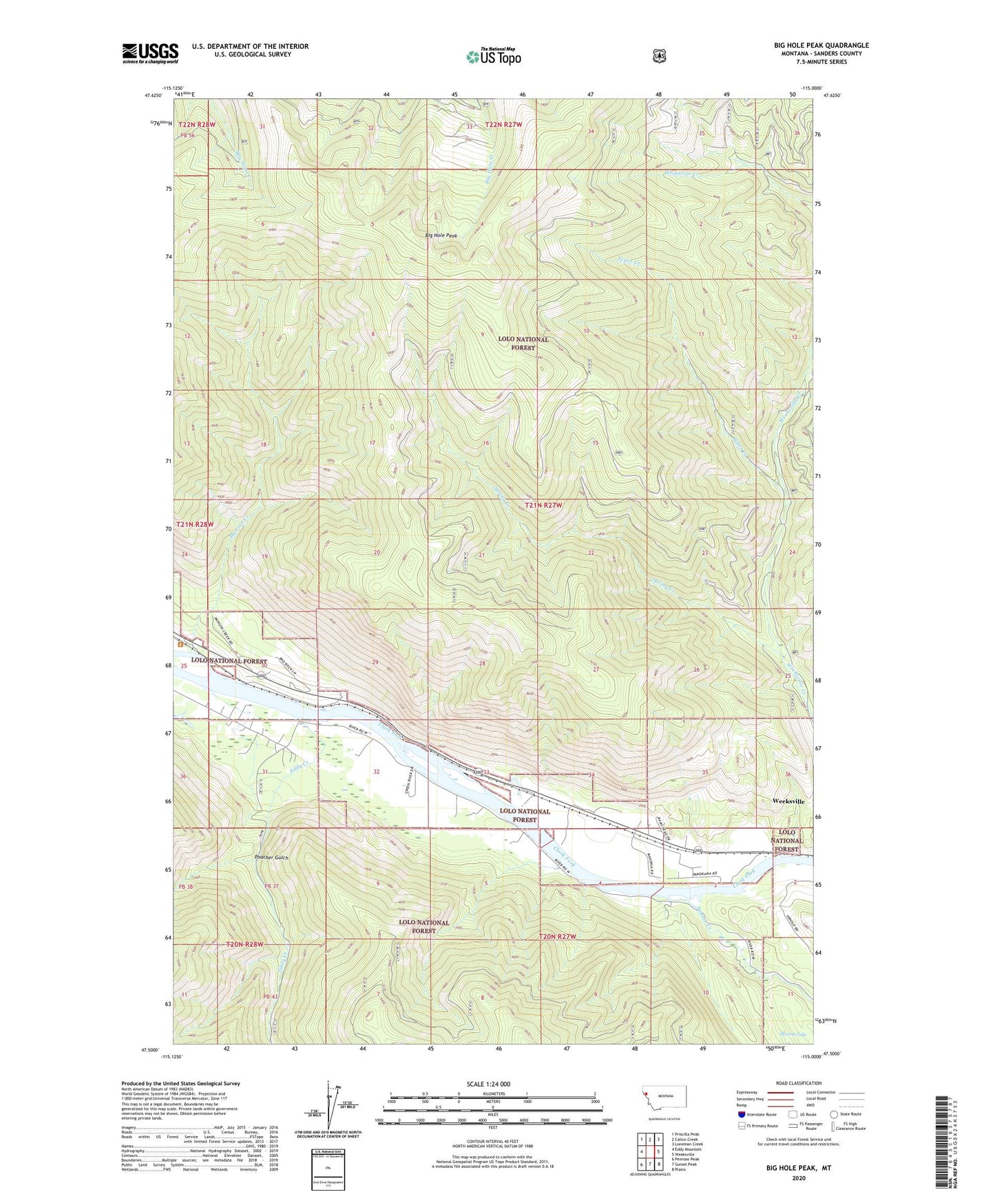
Big Hole Peak Montana US Topo Map
Couldn't load pickup availability
Also explore the Big Hole Peak Forest Service Topo of this same quad for updated USFS data
2024 topographic map quadrangle Big Hole Peak in the state of Montana. Scale: 1:24000. Based on the newly updated USGS 7.5' US Topo map series, this map is in the following counties: Sanders. The map contains contour data, water features, and other items you are used to seeing on USGS maps, but also has updated roads and other features. This is the next generation of topographic maps. Printed on high-quality waterproof paper with UV fade-resistant inks.
Quads adjacent to this one:
West: Eddy Mountain
Northwest: Priscilla Peak
North: Calico Creek
Northeast: Loneman Creek
East: Weeksville
Southeast: Plains
South: Sunset Peak
Southwest: Penrose Peak
This map covers the same area as the classic USGS quad with code o47115e1.
Contains the following named places: 20N27W03ABDB01 Well, 20N27W10AAAB01 Well, 20N27W10ABAD01 Well, Big Hole Peak, Eddy Creek, Flathead Post, McKay Landing Fishing Access Site, Munson Creek, Poacher Gulch, Russell, Spring Creek, Swamp Creek, Swamp Lake, Tepee Creek, Weeksville Census Designated Place