MyTopo
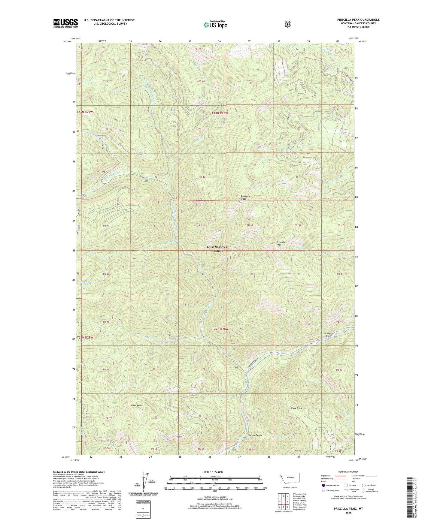
Priscilla Peak Montana US Topo Map
Couldn't load pickup availability
Also explore the Priscilla Peak Forest Service Topo of this same quad for updated USFS data
2024 topographic map quadrangle Priscilla Peak in the state of Montana. Scale: 1:24000. Based on the newly updated USGS 7.5' US Topo map series, this map is in the following counties: Sanders. The map contains contour data, water features, and other items you are used to seeing on USGS maps, but also has updated roads and other features. This is the next generation of topographic maps. Printed on high-quality waterproof paper with UV fade-resistant inks.
Quads adjacent to this one:
West: Mount Headley
Northwest: Vermilion Peak
North: Fishtrap Lake
Northeast: Richards Peak
East: Calico Creek
Southeast: Big Hole Peak
South: Eddy Mountain
Southwest: Thompson Falls
This map covers the same area as the classic USGS quad with code o47115f2.
Contains the following named places: Anne Creek, Bay State Creek, Big Spruce Creek, Clark Memorial Campground, Four Lakes Creek, Honeymoon Creek, Honeymoon Lake, Liver Peak, North Fork Four Lakes Creek, Priscilla Gulch, Priscilla Peak, Priscilla Peak Lookout, Sanders County, Sleepy Gulch, Sundance Ridge, View Point, West Fork Thompson River