MyTopo
Sunset Peak Montana US Topo Map
Couldn't load pickup availability
Also explore the Sunset Peak Forest Service Topo of this same quad for updated USFS data
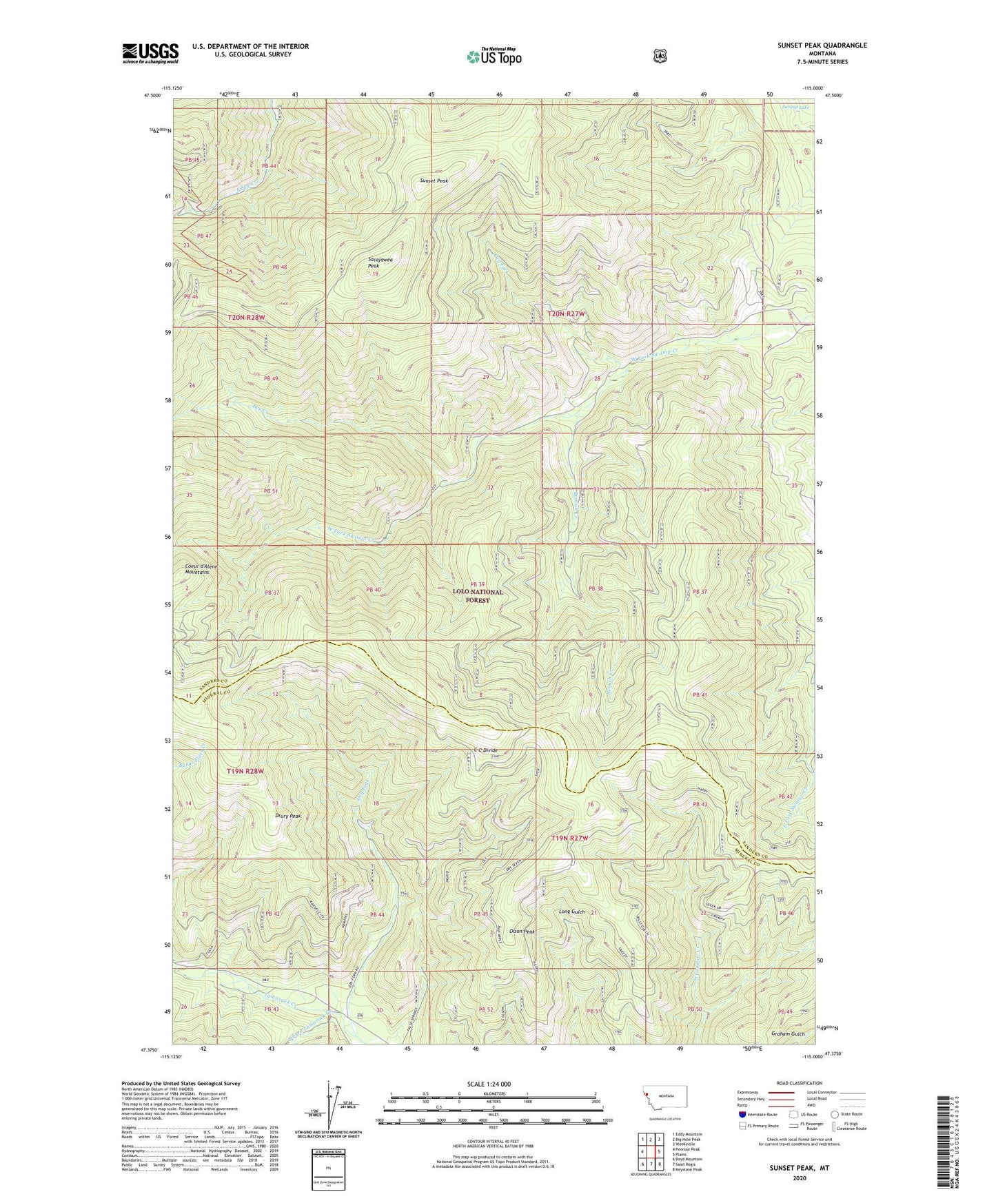
2024 topographic map quadrangle Sunset Peak in the state of Montana. Scale: 1:24000. Based on the newly updated USGS 7.5' US Topo map series, this map is in the following counties: Sanders, Mineral. The map contains contour data, water features, and other items you are used to seeing on USGS maps, but also has updated roads and other features. This is the next generation of topographic maps. Printed on high-quality waterproof paper with UV fade-resistant inks.
Quads adjacent to this one:
West: Penrose Peak
Northwest: Eddy Mountain
North: Big Hole Peak
Northeast: Weeksville
East: Plains
Southeast: Keystone Peak
South: Saint Regis
Southwest: Boyd Mountain
This map covers the same area as the classic USGS quad with code o47115d1.
Contains the following named places: Arvilla Lookout Station, Bemish Creek, Dee Creek, Dee Creek Mine, Drury Peak, Dry Fork, Eddy Creek Mine, Miller Mine, Olson Peak, Sacajawea Peak, South Fork Tamarack Creek, Sunset Peak, Upper Dee Creek Mine