MyTopo
Eldon Mountain Montana US Topo Map
Couldn't load pickup availability
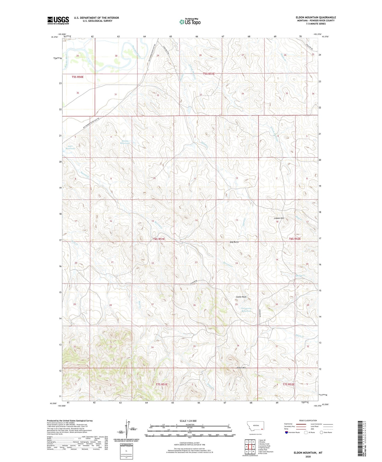
2020 topographic map quadrangle Eldon Mountain in the state of Montana. Scale: 1:24000. Based on the newly updated USGS 7.5' US Topo map series, this map is in the following counties: Powder River. The map contains contour data, water features, and other items you are used to seeing on USGS maps, but also has updated roads and other features. This is the next generation of topographic maps. Printed on high-quality waterproof paper with UV fade-resistant inks.
Quads adjacent to this one:
West: Lonesome Peak
Northwest: Epsie NE
North: Broadus
Northeast: Monday Creek
East: Fighting Butte
Southeast: Pine Creek
South: Bear Skull Mountain
Southwest: Baldy Peak
Contains the following named places: 05S50E25AADB01 Well, 05S51E27ABB_01 Well, 05S51E29AADC01 Well, 05S51E33ADAC01 Well, 05S51E35ACAC01 Well, 06S51E15BDCB01 Well, 06S51E20CDDD01 Well, 06S51E27CBCC01 Well, 06S52E07CB__01 Well, 06S52E17BDDC01 Well, 06S52E29CDBA01 Well, 59317, Castle Rock, Dog Butte, East Fork Third Creek, Eldon Mountain, Forsgreen Reservoir, Garr Reservoir, Hondu Reservoir, Lideen Hill, Russell Number 1 Dam