MyTopo
Bear Skull Mountain Montana US Topo Map
Couldn't load pickup availability
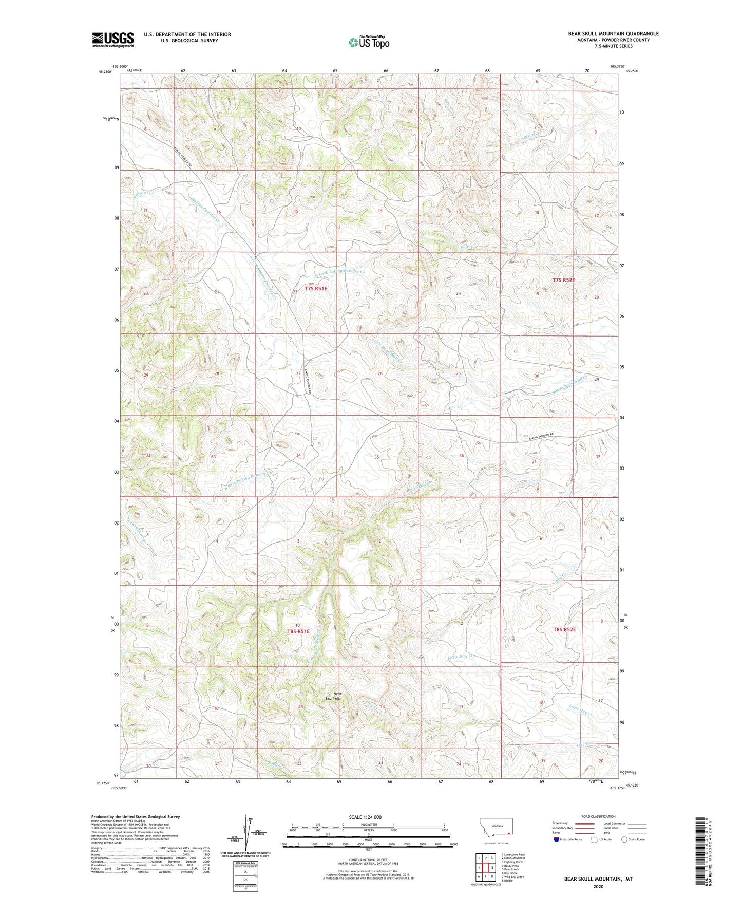
2024 topographic map quadrangle Bear Skull Mountain in the state of Montana. Scale: 1:24000. Based on the newly updated USGS 7.5' US Topo map series, this map is in the following counties: Powder River. The map contains contour data, water features, and other items you are used to seeing on USGS maps, but also has updated roads and other features. This is the next generation of topographic maps. Printed on high-quality waterproof paper with UV fade-resistant inks.
Quads adjacent to this one:
West: Baldy Peak
Northwest: Lonesome Peak
North: Eldon Mountain
Northeast: Fighting Butte
East: Pine Creek
Southeast: Biddle
South: Wild Bill Creek
Southwest: Bay Horse
This map covers the same area as the classic USGS quad with code o45105b4.
Contains the following named places: 07S51E27BBDA01 Well, 07S51E34DBDB01 Well, 08S51E01DCDB01 Well, 08S51E12DCBB01 Well, Allison Creek, Bear Skull Mountain, North Fork Baking Powder Creek, South Fork Baking Powder Creek