MyTopo
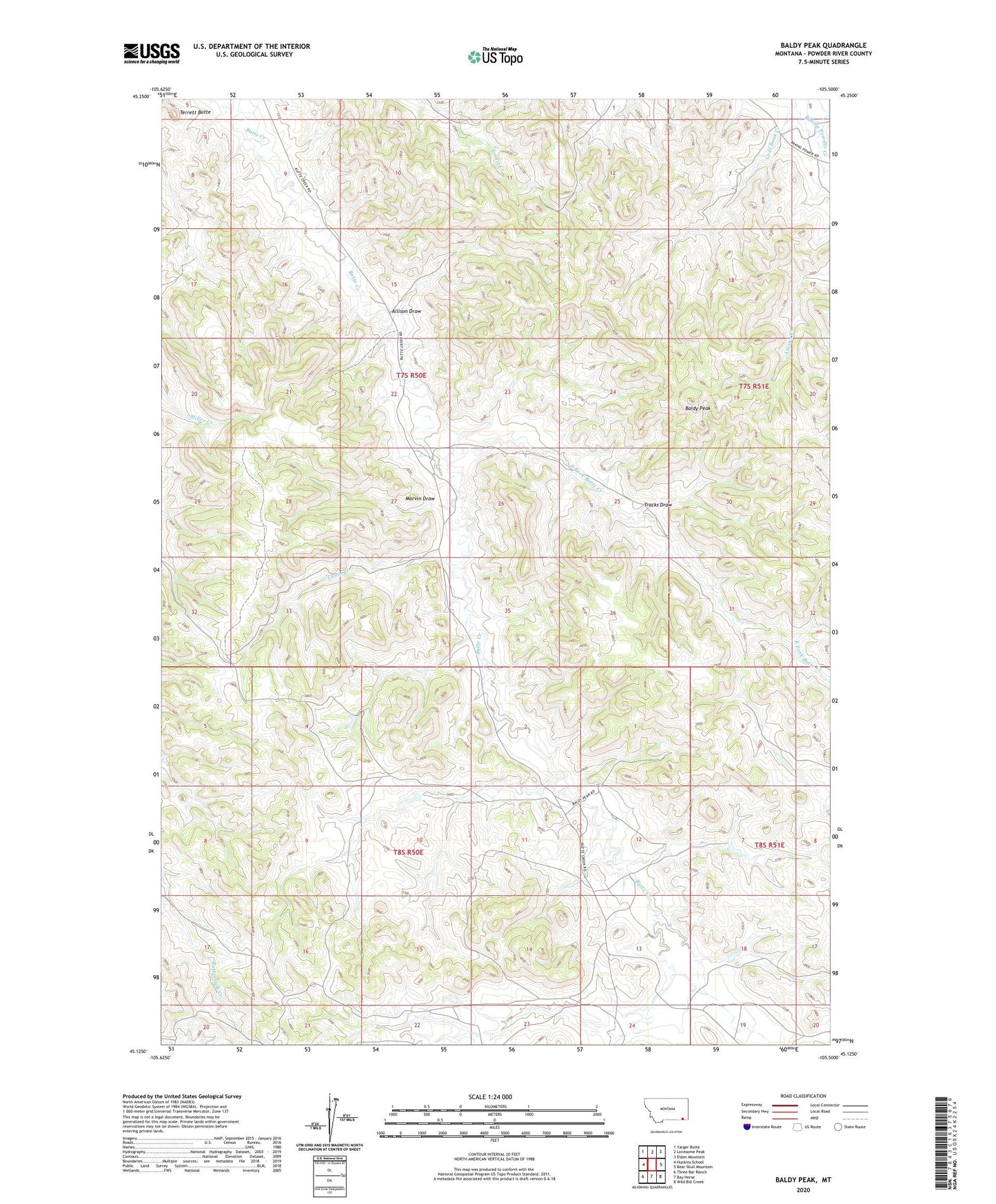
Baldy Peak Montana US Topo Map
Couldn't load pickup availability
2024 topographic map quadrangle Baldy Peak in the state of Montana. Scale: 1:24000. Based on the newly updated USGS 7.5' US Topo map series, this map is in the following counties: Powder River. The map contains contour data, water features, and other items you are used to seeing on USGS maps, but also has updated roads and other features. This is the next generation of topographic maps. Printed on high-quality waterproof paper with UV fade-resistant inks.
Quads adjacent to this one:
West: Huckins School
Northwest: Yarger Butte
North: Lonesome Peak
Northeast: Eldon Mountain
East: Bear Skull Mountain
Southeast: Wild Bill Creek
South: Bay Horse
Southwest: Three Bar Ranch
This map covers the same area as the classic USGS quad with code o45105b5.
Contains the following named places: 07S50E12ADBA01 Well, 07S50E22BDAD01 Well, 07S50E23CCCC01 Well, 07S50E23CDCD01 Well, 07S50E26BCBC01 Well, 07S51E07ACDB01 Well, 08S50E24ABAA01 Well, 08S51E18CBDB01 Well, Allison Draw, Baldy Peak, Butte Creek School, Cabin Creek, Coal Bank Creek, East Fork Butte Creek, Marvin Draw, Rumph School, Terrett Butte, Tracks Draw