MyTopo
Fighting Butte Montana US Topo Map
Couldn't load pickup availability
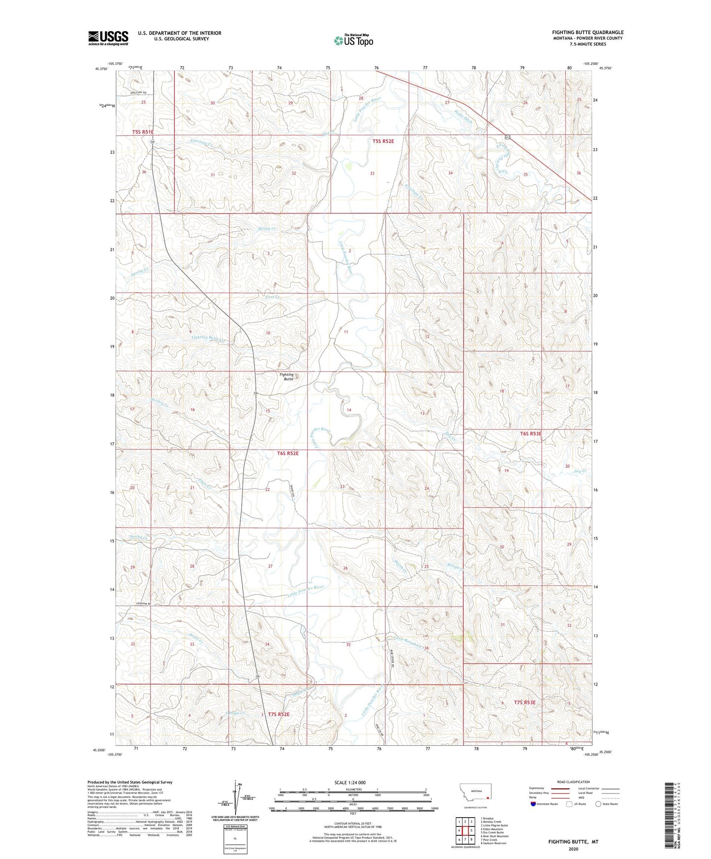
2024 topographic map quadrangle Fighting Butte in the state of Montana. Scale: 1:24000. Based on the newly updated USGS 7.5' US Topo map series, this map is in the following counties: Powder River. The map contains contour data, water features, and other items you are used to seeing on USGS maps, but also has updated roads and other features. This is the next generation of topographic maps. Printed on high-quality waterproof paper with UV fade-resistant inks.
Quads adjacent to this one:
West: Eldon Mountain
Northwest: Broadus
North: Monday Creek
Northeast: Little Pilgrim Butte
East: Dry Creek Butte
Southeast: Sanburn Reservoir
South: Pine Creek
Southwest: Bear Skull Mountain
This map covers the same area as the classic USGS quad with code o45105c3.
Contains the following named places: 01S52E33ACCB01 Well, 04S52E23DCBB01 Well, 05S51E25BDDB01 Well, 05S52E31BBCA01 Well, 05S52E32ACD_01 Well, 05S52E35ADCA01 Well, 06S52E03ACAB01 Well, 06S52E10BADB01 Well, 06S52E13DCAD01 Well, 06S52E21DABA01 Well, 06S52E22ABDA01 Well, 06S52E22BC__01 Well, 06S52E22DDDD01 Well, 06S52E26AABA01 Well, 06S52E34CCD_01 Well, 06S53E17DBB_01 Well, 06S53E20CB__01 Well, 07S52E02CA__01 Well, 30N49E26DADA01 Well, Antelope Creek, Dogie Creek, Dry Creek, East Powder River Division, Fighting Butte, Fighting Butte Creek, Flat Creek, Hockey Creek, Little Rough Creek, Plum Creek, Rough Creek, Skunk Creek, South Dogie Creek, Spring Creek, Tiret Creek, Waite Ditch