MyTopo
Elevation Mountain Montana US Topo Map
Couldn't load pickup availability
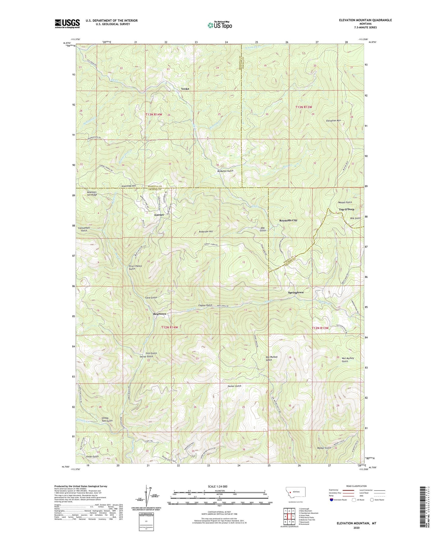
2020 topographic map quadrangle Elevation Mountain in the state of Montana. Scale: 1:24000. Based on the newly updated USGS 7.5' US Topo map series, this map is in the following counties: Granite, Missoula, Powell. The map contains contour data, water features, and other items you are used to seeing on USGS maps, but also has updated roads and other features. This is the next generation of topographic maps. Printed on high-quality waterproof paper with UV fade-resistant inks.
Quads adjacent to this one:
West: Union Peak
Northwest: Greenough
North: Bata Mountain
Northeast: Chamberlain Mountain
East: Wild Horse Parks
Southeast: Drummond
South: Bearmouth
Southwest: Medicine Tree Hill
Contains the following named places: Alcona Mine, Amex Number 1 Mine, Amex Number 5 Mine, Anaconda Hill, Anderson Hill, Austin Mine, Beartown, Beartown Post Office, Berlene Mine, Bilk, Boston Mine, Cardinal Mine, Cascade Mine, Cave Gulch, Cave Hill-Fairview Mine, Cayuse Gulch, Dandy Mine, Day Gulch, Deep Creek, Deer Creek, Elevation Mountain, Fairview Mine, Finn Gulch, First Chance Gulch, Fourth of July Mine, Free Coin - Redcloud Mill Mine, Gambler Creek, Garnet, Garnet Mine, Garnet Post Office, Garnet School, Goldleaf Mine, Grant and Hartford Mine, Harparanda Mine, Herzer and Green Mine, Homestake Mine, Independence Mine, International Mine, Kearns Creek, Kennedy Creek, Keno Creek, Lehson Mine, Lynx Mine, Magone and Anderson Mine, McGinnis Creek, McManus Gulch, Mountain Mine, Mountain View Mine, Nancy Hanks Mine, Nineteen ten Ridge, North Fork Elk Creek, NW Section 10 Mine, Pearl Fraction Mine, Pearl Mine, Peggy Ann Mine, Red Cloud Mine, Redrock Mine, Reynolds City, Robert Emmet Mine, San Jose Mine, SE Section 2 Mine, Secret Gulch, Shamrock Mine, Sierra Mine, Skimmerhorn Creek, Sleepy Tom Gulch, Spokane Mine, Springtown, Stone Mine, Stump Town, Summit Cabin, Tenmile, Tenmile Creek, Tiger Mine, Top O Deep Post Office, Top O'Deep, Tostman Mine, Walker Gulch, Willie Mine, Yreka, Yreka Post Office