MyTopo
Union Peak Montana US Topo Map
Couldn't load pickup availability
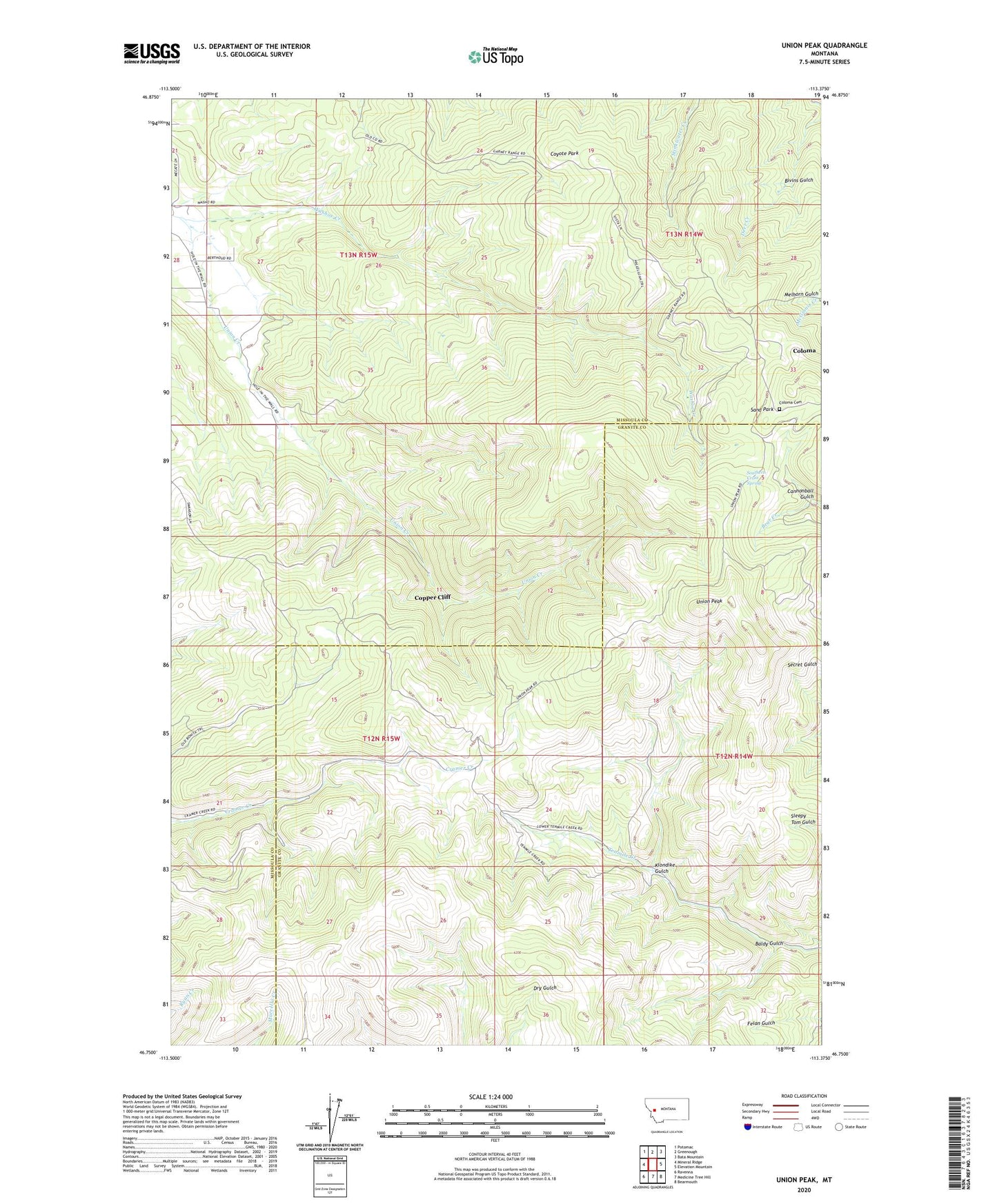
2024 topographic map quadrangle Union Peak in the state of Montana. Scale: 1:24000. Based on the newly updated USGS 7.5' US Topo map series, this map is in the following counties: Missoula, Granite. The map contains contour data, water features, and other items you are used to seeing on USGS maps, but also has updated roads and other features. This is the next generation of topographic maps. Printed on high-quality waterproof paper with UV fade-resistant inks.
Quads adjacent to this one:
West: Mineral Ridge
Northwest: Potomac
North: Greenough
Northeast: Bata Mountain
East: Elevation Mountain
Southeast: Bearmouth
South: Medicine Tree Hill
Southwest: Ravenna
This map covers the same area as the classic USGS quad with code o46113g4.
Contains the following named places: Baldy Gulch, Bivins Gulch, Cannonball Gulch, Cato Mine, Chicken Run, Clemantha Mine, Cliff Post Office, Coloma, Coloma Cemetery, Coloma Post Office, Comet Mine, Copper Cliff, Copper Cliff Mine, Coyote Park, Deer Creek Mine, Frogs Diner Mine, Klondike Gulch, Leonard Mine, Mammoth Junior Mine, Mammoth Mine, Melhorn Gulch, Sand Park, Southern Cross Spring, SW Section 32 Mine, Union Peak, Washoe Creek