MyTopo
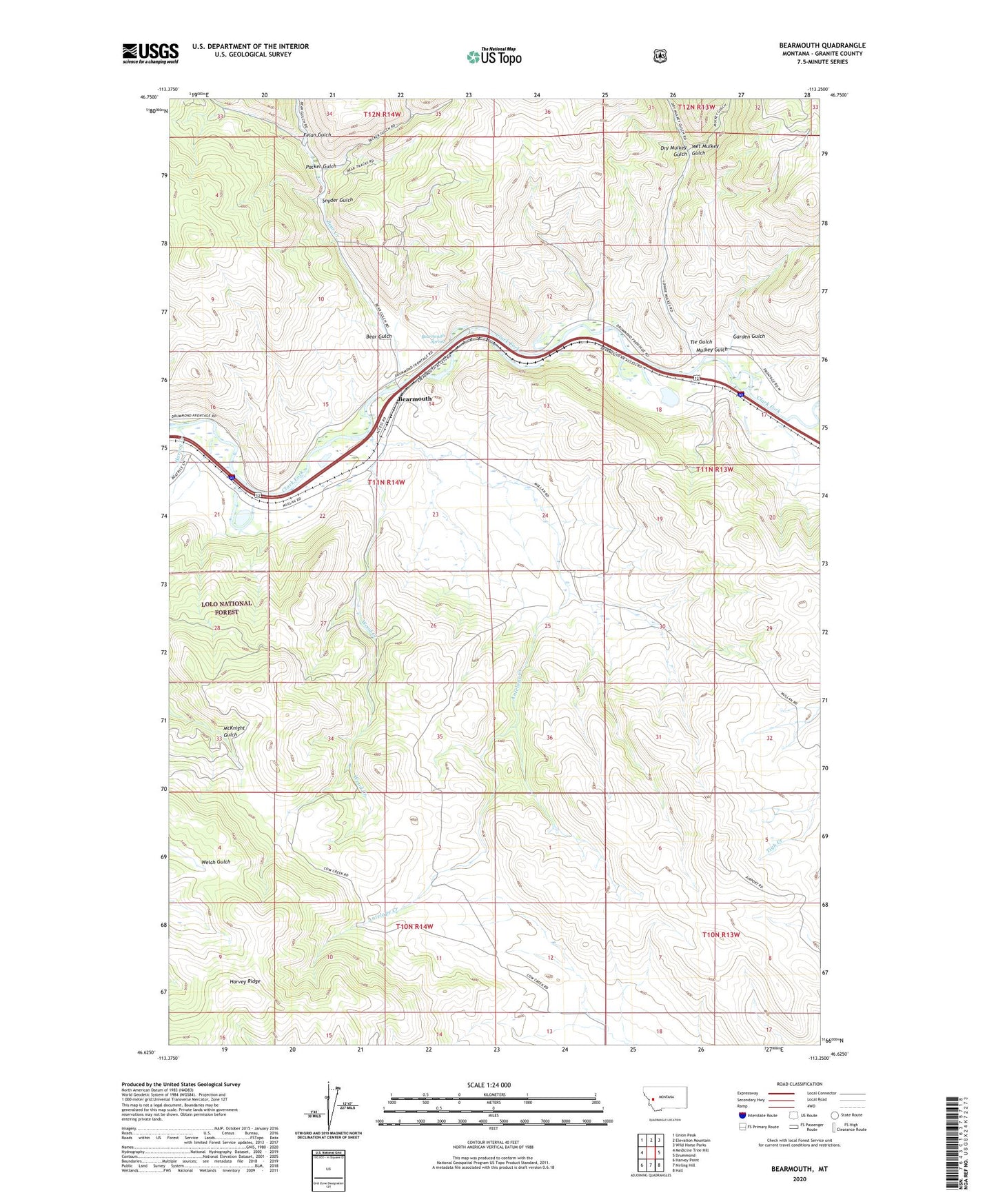
Bearmouth Montana US Topo Map
Couldn't load pickup availability
Also explore the Bearmouth Forest Service Topo of this same quad for updated USFS data
2024 topographic map quadrangle Bearmouth in the state of Montana. Scale: 1:24000. Based on the newly updated USGS 7.5' US Topo map series, this map is in the following counties: Granite. The map contains contour data, water features, and other items you are used to seeing on USGS maps, but also has updated roads and other features. This is the next generation of topographic maps. Printed on high-quality waterproof paper with UV fade-resistant inks.
Quads adjacent to this one:
West: Medicine Tree Hill
Northwest: Union Peak
North: Elevation Mountain
Northeast: Wild Horse Parks
East: Drummond
Southeast: Hall
South: Nirling Hill
Southwest: Harvey Point
This map covers the same area as the classic USGS quad with code o46113f3.
Contains the following named places: 11N13W07CBCD01 Well, 11N13W07DDCD01 Well, 11N13W07DDCD02 Well, 11N13W07DDDA01 Well, 11N13W07DDDB01 Well, 11N13W08CC__01 Well, 11N13W08CDCB01 Well, 11N13W08CDCD01 Well, 11N13W17ADA_01 Well, 11N13W17BABA01 Well, 11N13W17BABB01 Well, 11N13W17BDAA01 Well, 11N14W11DCAC01 Well, 11N14W14BBCC01 Well, 11N14W14BBCD01 Well, 11N14W14CBDB01 Well, 11N14W15DDA_01 Well, 11N14W15DDB_01 Well, 11N14W16CCCD01 Well, 11N14W16CCDC01 Well, 11N14W16CDCB01 Well, 59832, Antelope Creek, Bear Creek, Bear Gulch, Bearmouth, Bearmouth Historical Marker, Bearmouth Post Office, Bearmouth Rest Area, Bearmouth School, Bearmouth Spring, Birmingham Flats, Cow Creek School, Dry Mulkey Gulch, Felan Gulch, Garden Gulch, Harvey Creek, Hell Gate, Hellgate Post Office, Mulkey Gulch, Packer Gulch, Snyder Gulch, Tie Gulch, Wet Mulkey Gulch, Wood Creek