MyTopo
Elkhorn Creek SE Montana US Topo Map
Couldn't load pickup availability
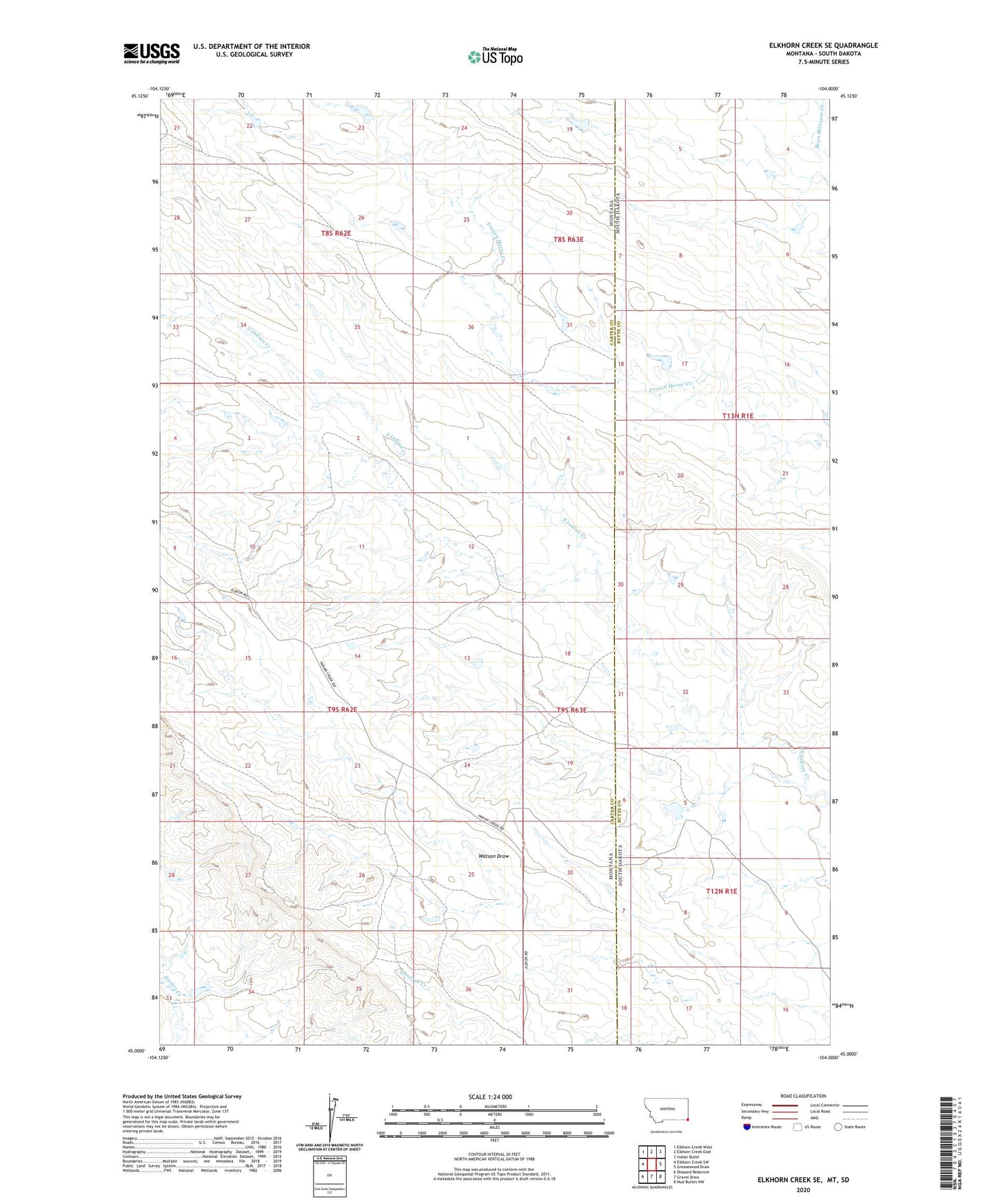
2024 topographic map quadrangle Elkhorn Creek SE in the state of Montana. Scale: 1:24000. Based on the newly updated USGS 7.5' US Topo map series, this map is in the following counties: Carter, Butte. The map contains contour data, water features, and other items you are used to seeing on USGS maps, but also has updated roads and other features. This is the next generation of topographic maps. Printed on high-quality waterproof paper with UV fade-resistant inks.
Quads adjacent to this one:
West: Elkhorn Creek SW
Northwest: Elkhorn Creek West
North: Elkhorn Creek East
Northeast: Indian Butte
East: Greasewood Draw
Southeast: Mud Buttes NW
South: Gravel Draw
Southwest: Shepard Reservoir
Contains the following named places: 09S62E23DA__01 Well, Grumpy Dam, Morgan Ranche Airport