MyTopo
Gravel Draw Wyoming US Topo Map
Couldn't load pickup availability
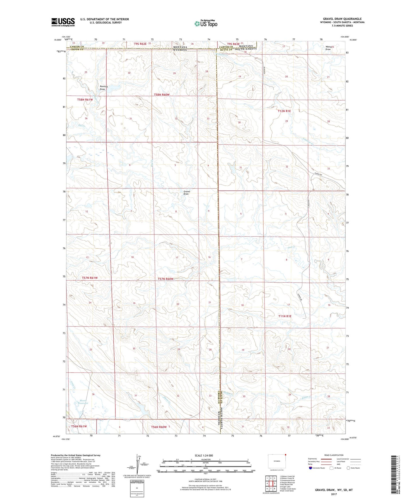
2021 topographic map quadrangle Gravel Draw in the states of Wyoming, South Dakota, Montana. Scale: 1:24000. Based on the newly updated USGS 7.5' US Topo map series, this map is in the following counties: Crook, Butte, Carter. The map contains contour data, water features, and other items you are used to seeing on USGS maps, but also has updated roads and other features. This is the next generation of topographic maps. Printed on high-quality waterproof paper with UV fade-resistant inks.
Quads adjacent to this one:
West: Shepard Reservoir
Northwest: Elkhorn Creek SW
North: Elkhorn Creek SE
Northeast: Greasewood Draw
East: Mud Buttes NW
Southeast: Bull Creek Butte
South: Middle Creek Butte
Southwest: Kruger Lake
This map covers the same area as the classic USGS quad with code o44104h1.
Contains the following named places: Courtemanche Ranch, Easter Creek, Geisinger Ranch, Gravel Draw, Moore Dam, Moore Reservoir, Mowry Draw Dam, Mowry Draw Reservoir, Owl Creek Dam, Owl Creek Reservoir, Ronning Draw, Sloan Brothers Ranch, Township of Hay Creek