MyTopo
Bridge Coulee Montana US Topo Map
Couldn't load pickup availability
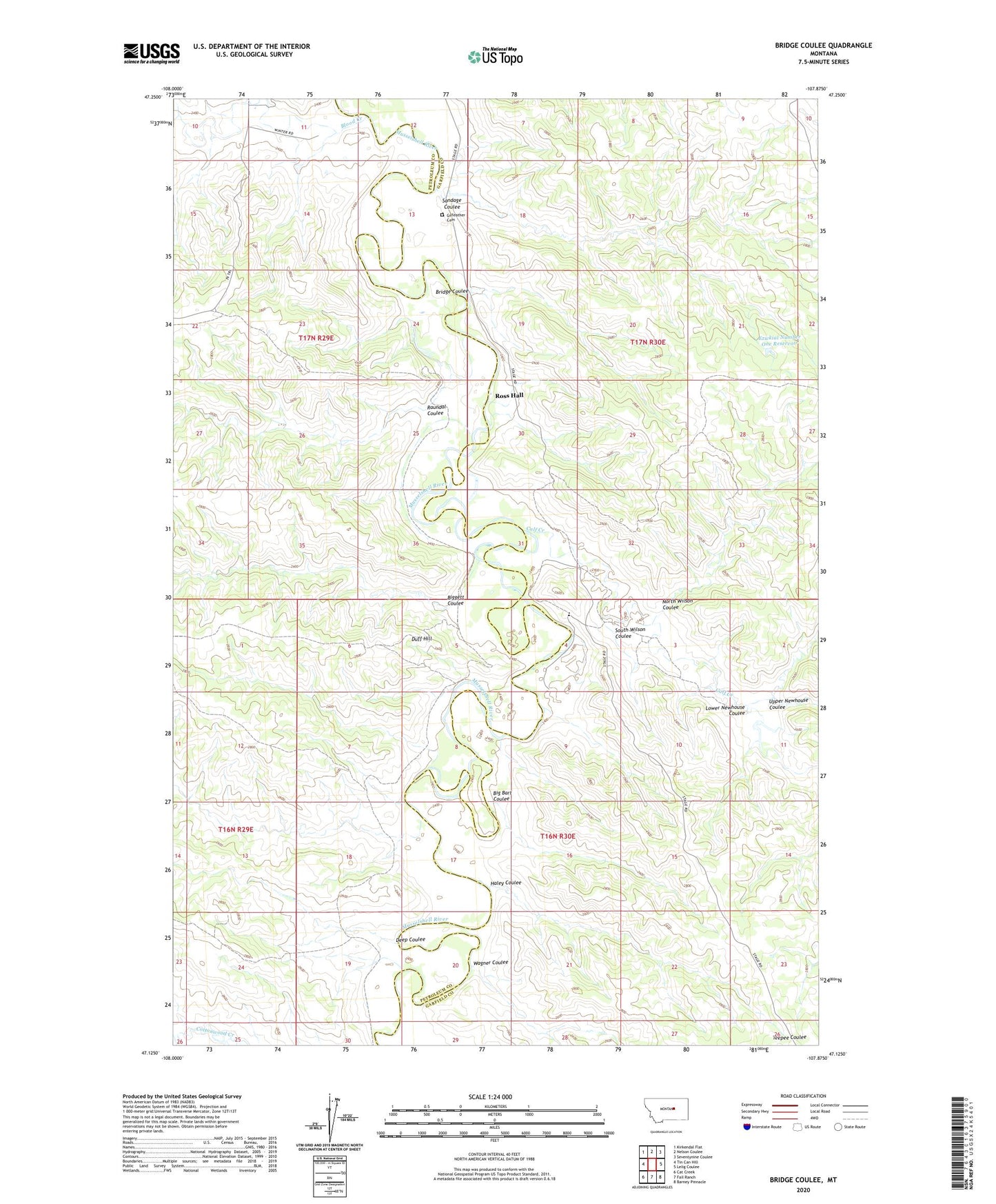
2024 topographic map quadrangle Bridge Coulee in the state of Montana. Scale: 1:24000. Based on the newly updated USGS 7.5' US Topo map series, this map is in the following counties: Garfield, Petroleum. The map contains contour data, water features, and other items you are used to seeing on USGS maps, but also has updated roads and other features. This is the next generation of topographic maps. Printed on high-quality waterproof paper with UV fade-resistant inks.
Quads adjacent to this one:
West: Tin Can Hill
Northwest: Kirkendal Flat
North: Nelson Coulee
Northeast: Seventynine Coulee
East: Lelig Coulee
Southeast: Barney Pinnacle
South: Fail Ranch
Southwest: Cat Creek
This map covers the same area as the classic USGS quad with code o47107b8.
Contains the following named places: Big Bart Coulee, Biggett Coulee, Blood Creek, Bridge Coulee, Calf Creek, Deep Coulee, Duff Hill, Ezwkial Number One Reservoir, Gilfeather Cemetery, Haley Coulee, Lower Newhouse Coulee, North Wilson Coulee, Raundal Coulee, Ross Hall, Ross Post Office, Ross School, Sandage Coulee, South Wilson Coulee, Upper Newhouse Coulee, Wagner Coulee