MyTopo
Woods Water Montana US Topo Map
Couldn't load pickup availability
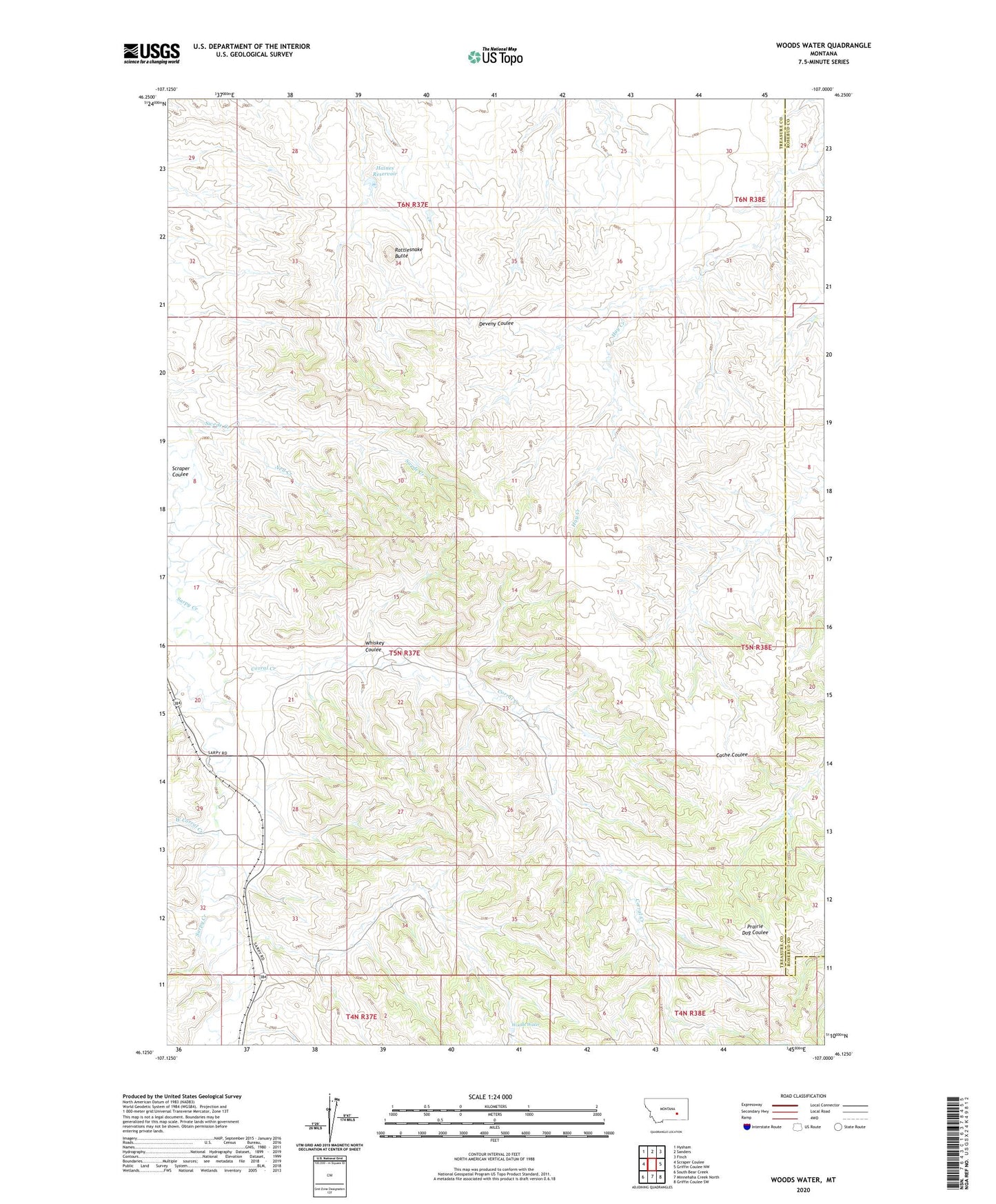
2024 topographic map quadrangle Woods Water in the state of Montana. Scale: 1:24000. Based on the newly updated USGS 7.5' US Topo map series, this map is in the following counties: Treasure, Rosebud. The map contains contour data, water features, and other items you are used to seeing on USGS maps, but also has updated roads and other features. This is the next generation of topographic maps. Printed on high-quality waterproof paper with UV fade-resistant inks.
Quads adjacent to this one:
West: Scraper Coulee
Northwest: Hysham
North: Sanders
Northeast: Finch
East: Griffin Coulee NW
Southeast: Griffin Coulee SW
South: Minnehaha Creek North
Southwest: South Bear Creek
This map covers the same area as the classic USGS quad with code o46107b1.
Contains the following named places: 05N37E08DCDC01 Well, Corral Creek, Criswell Ranch, Haines Reservoir, Haines Reservoir Dam, Mike, Nell Creek, Rattlesnake Butte, Scraper Coulee, West Corral Creek, Whiskey Coulee, Woods Water